MORPC Central Ohio Greenways Regional Trail Guide
Central Ohio
WHY
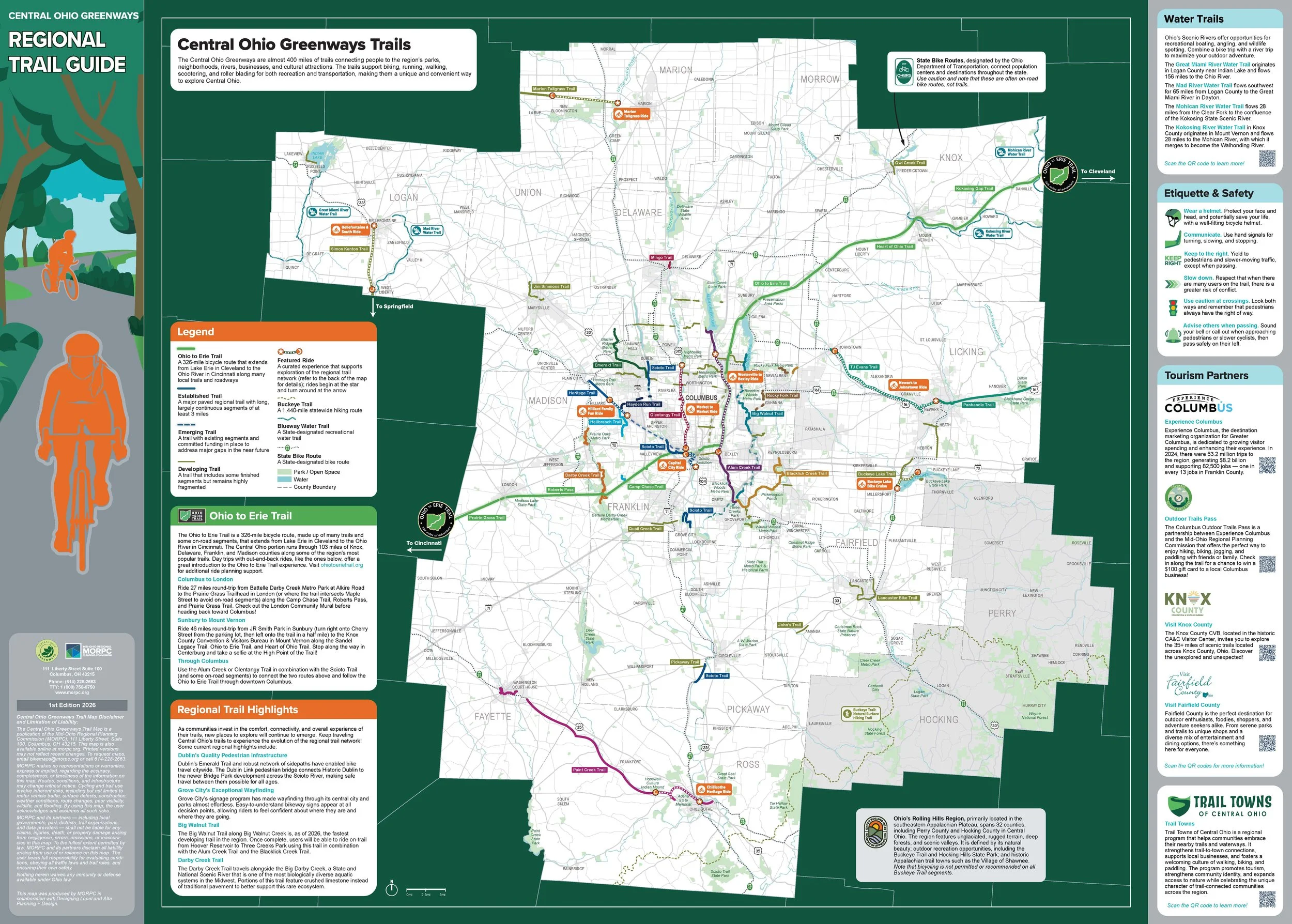
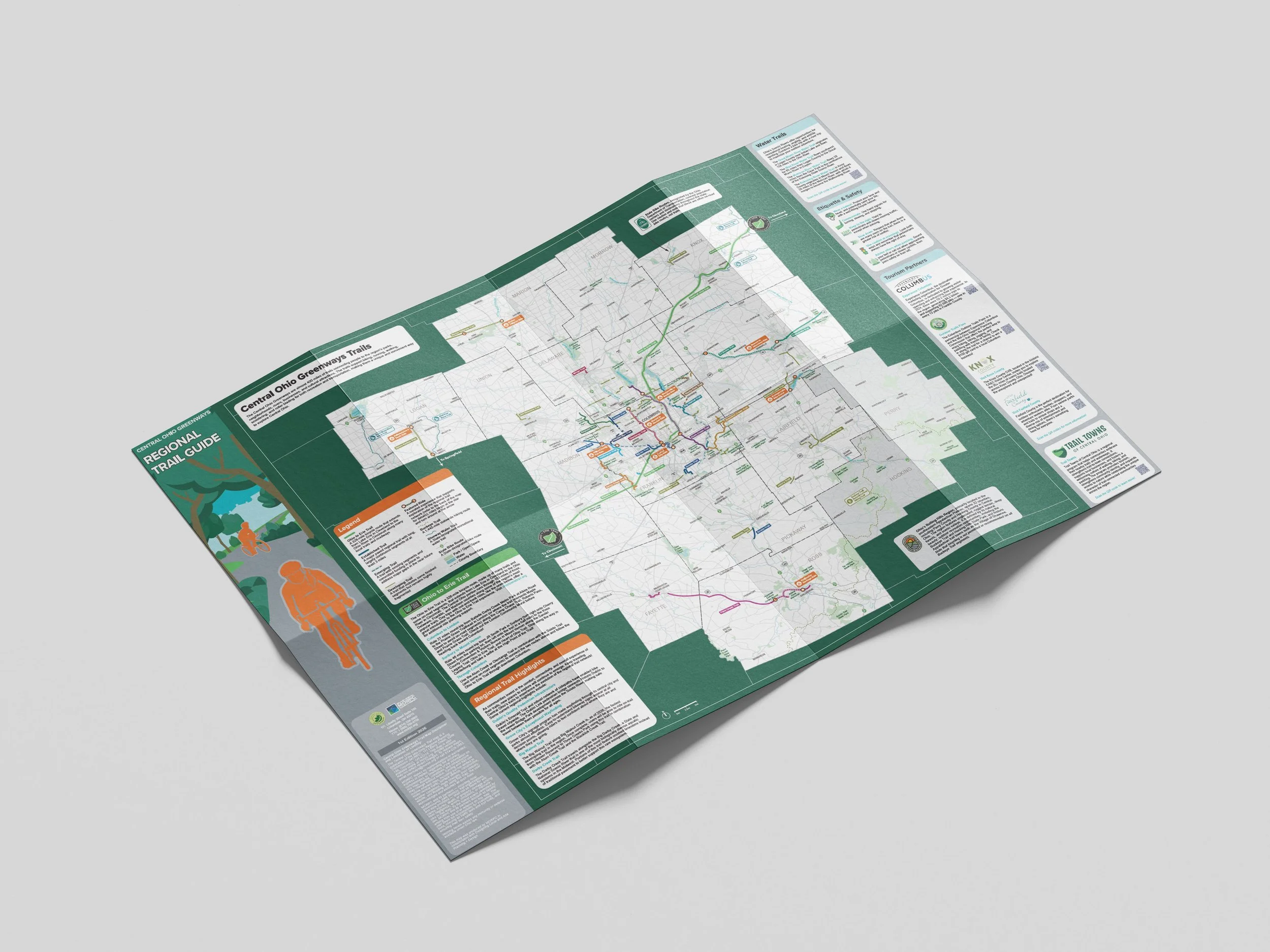
The Central Ohio Greenways (COG) features almost 400 miles of trails that connect Central Ohio’s parks, waterways, neighborhoods, business districts, and cultural attractions, offering trail users ample opportunities for recreation, transportation, and exploration. The trail system has evolved significantly over the past decade, and recently grew from 7 counties to 15 when the Mid-Ohio Regional Planning Commission (MORPC) expanded its regional footprint. As COG leadership works to add trail miles to further grow the network, it is also focused on enhancing the experience of trail travel through initiatives including a new Trail Towns of Central Ohio program and various wayfinding projects. The Regional Trail Guide was intended to facilitate wayfinding and make it easier for people to access all the trail system has to offer. It complements MORPC’s efforts to update its 10-year-old Columbus Metro Bike Map by “zooming out” to show a complete picture of the 15-county COG network; the back of the regional map features 9 curated routes that will help people access trail experiences. This project also supported five Trail Towns of Central Ohio communities through identity builder workshops that generated feedback to inform their marketing materials.
HOW
MAPPING
The regional trail map and maps of the curated rides were developed from GIS-based trail data, provided by MORPC, that was stylized in Adobe Illustrator through an iterative process to balance accuracy and visual clarity at the regional scale. Team members rode a dozen trails and identified 9 that would make good introductory rides to feature on the map, then wrote narratives about how to approach each and what trailside or trail-adjacent destinations to explore.
COMMUNITY ENGAGEMENT
Designing Local employed a variety of engagement methods to ensure the map and curated routes were accurate, and that they reflected community priorities. These included a Steering Committee of local stakeholders to inform the process; an online survey to ascertain what people wanted to see on the map and how they would use it; meetings with Trail Managers and other stakeholders for feedback into which destinations should be highlighted on the curated routes, and “gallery walks” at which near-final draft maps were displayed in public spaces throughout the region for people to review.
TRAIL TOWNS WORKSHOPS
Designing Local designed and delivered fun, highly interactive workshops for local leaders, business owners, trail advocates, tourism professionals, and city and county staff that helped them articulate their communities’ identities — information that was used to support the creation of their custom badges and Trail Towns StoryMap templates.
WHAT
Designing Local was responsible for three project deliverables:
A bike map of the entire 15-county Central Ohio Greenways trail system featuring 9 curated routes to help people understand how to access the trails
Summaries of the findings from five identity building workshops with Trail Towns of Central Ohio communities
A Style Guide to support future MORPC mapping projects
The final project document traces the process by which team members arrived at the final map and curated routes. It also includes the Style Guide in full, the Trail Towns workshop summaries, and the community feedback that informed all deliverables.