Urban Planning & Design Designing Local 6/1/26 Urban Planning & Design Designing Local 6/1/26 Westerville Wayfinding Strategy Westerville, Ohio Read More Urban Planning & Design Designing Local 9/23/24 Urban Planning & Design Designing Local 9/23/24 Fairfield Town Center Placemaking Strategy Read More Urban Planning & Design, Parks & Recreation Designing Local 4/5/24 Urban Planning & Design, Parks & Recreation Designing Local 4/5/24 Central Ohio Greenways Wayfinding Strategy Guide Read More Urban Planning & Design Designing Local 3/20/23 Urban Planning & Design Designing Local 3/20/23 Belle Valley Revitalization Plan Read More Urban Planning & Design, Community Engagement Designing Local 10/18/22 Urban Planning & Design, Community Engagement Designing Local 10/18/22 Buckeye Hills Regional Council Downtown Workshops Read More Historic Preservation Matt Leasure 6/15/22 Historic Preservation Matt Leasure 6/15/22 Ohio & Erie Canal Southern Descent NRHP Nomination Read More Landscape Architecture, Urban Planning & Design, Parks & Recreation Matt Leasure 6/15/22 Landscape Architecture, Urban Planning & Design, Parks & Recreation Matt Leasure 6/15/22 Lockbourne Veterans Park Read More Landscape Architecture, Urban Planning & Design Designing Local 3/30/22 Landscape Architecture, Urban Planning & Design Designing Local 3/30/22 Downtown Caldwell Revitalization Plan Read More Landscape Architecture, Urban Planning & Design, Parks & Recreation Designing Local 9/13/19 Landscape Architecture, Urban Planning & Design, Parks & Recreation Designing Local 9/13/19 Cape May County Creative Placemaking Plan Read More
Urban Planning & Design Designing Local 6/1/26 Urban Planning & Design Designing Local 6/1/26 Westerville Wayfinding Strategy Westerville, Ohio Read More
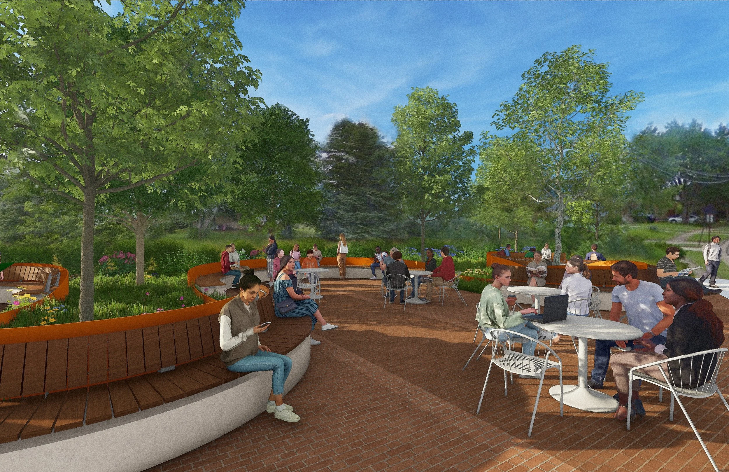
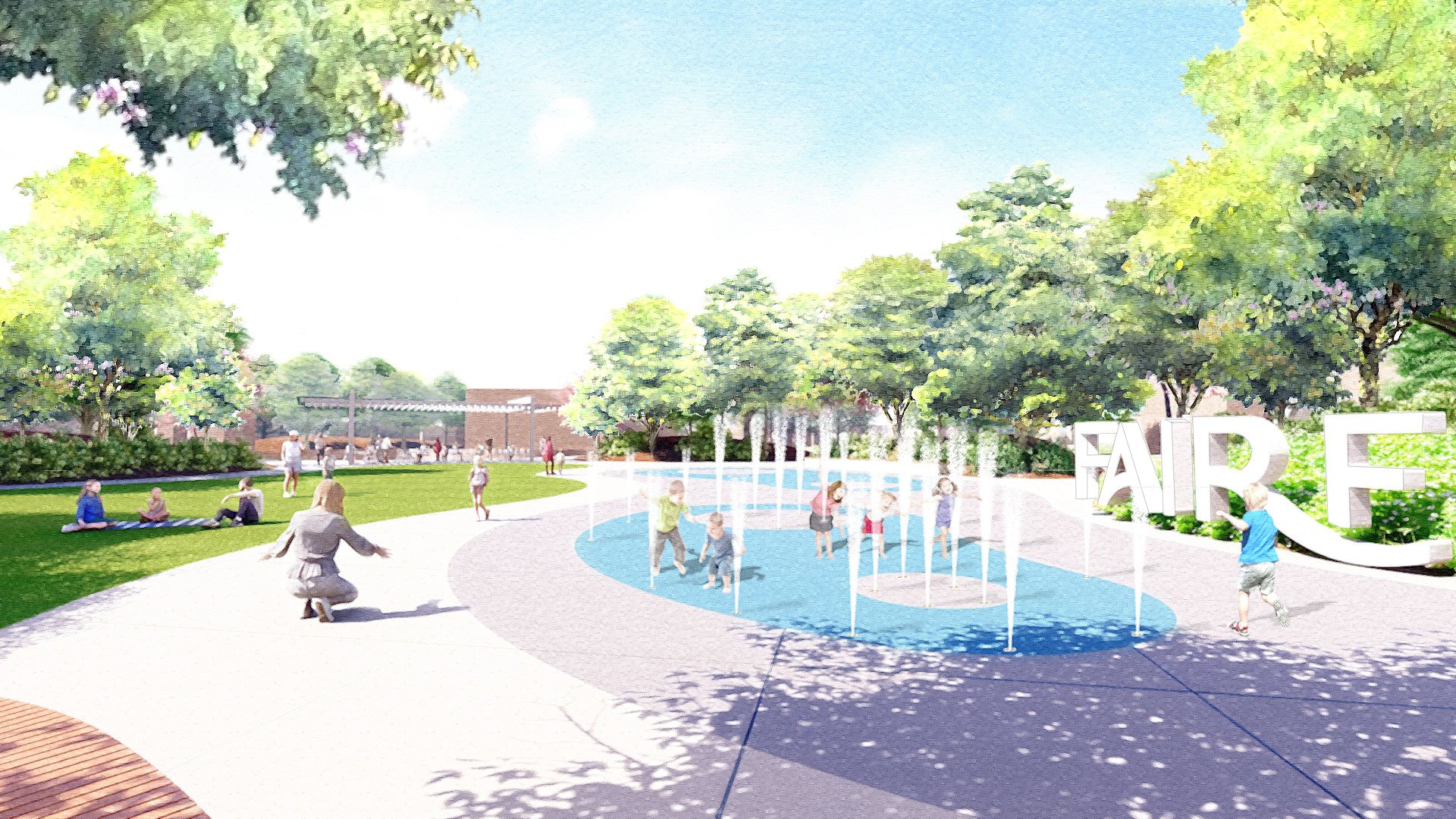
Urban Planning & Design Designing Local 9/23/24 Urban Planning & Design Designing Local 9/23/24 Fairfield Town Center Placemaking Strategy Read More
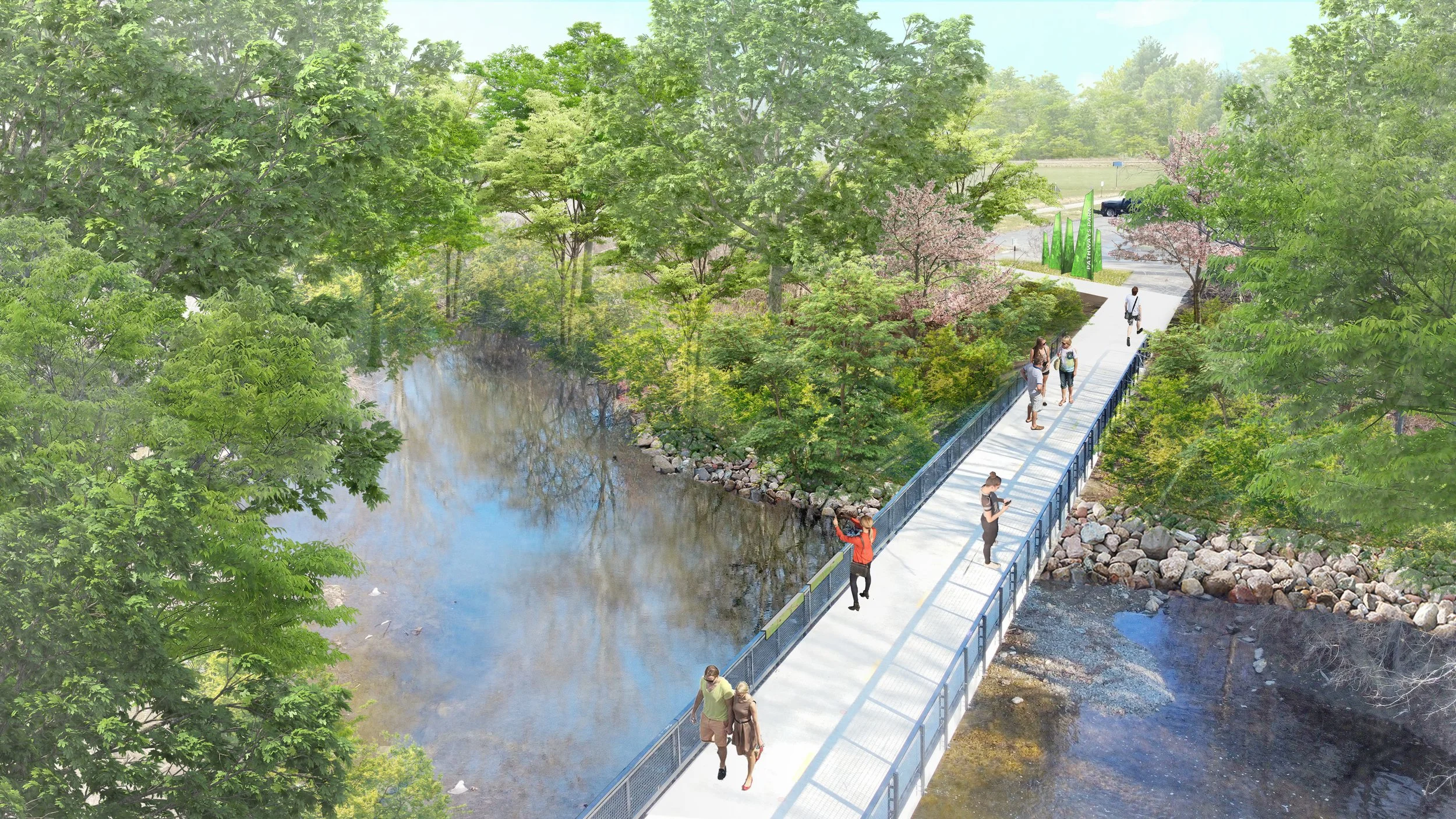
Urban Planning & Design, Parks & Recreation Designing Local 4/5/24 Urban Planning & Design, Parks & Recreation Designing Local 4/5/24 Central Ohio Greenways Wayfinding Strategy Guide Read More
Urban Planning & Design Designing Local 3/20/23 Urban Planning & Design Designing Local 3/20/23 Belle Valley Revitalization Plan Read More
Urban Planning & Design, Community Engagement Designing Local 10/18/22 Urban Planning & Design, Community Engagement Designing Local 10/18/22 Buckeye Hills Regional Council Downtown Workshops Read More
Historic Preservation Matt Leasure 6/15/22 Historic Preservation Matt Leasure 6/15/22 Ohio & Erie Canal Southern Descent NRHP Nomination Read More
Landscape Architecture, Urban Planning & Design, Parks & Recreation Matt Leasure 6/15/22 Landscape Architecture, Urban Planning & Design, Parks & Recreation Matt Leasure 6/15/22 Lockbourne Veterans Park Read More
Landscape Architecture, Urban Planning & Design Designing Local 3/30/22 Landscape Architecture, Urban Planning & Design Designing Local 3/30/22 Downtown Caldwell Revitalization Plan Read More
Landscape Architecture, Urban Planning & Design, Parks & Recreation Designing Local 9/13/19 Landscape Architecture, Urban Planning & Design, Parks & Recreation Designing Local 9/13/19 Cape May County Creative Placemaking Plan Read More