Campus District Master Plan
Cleveland, Ohio
WHY
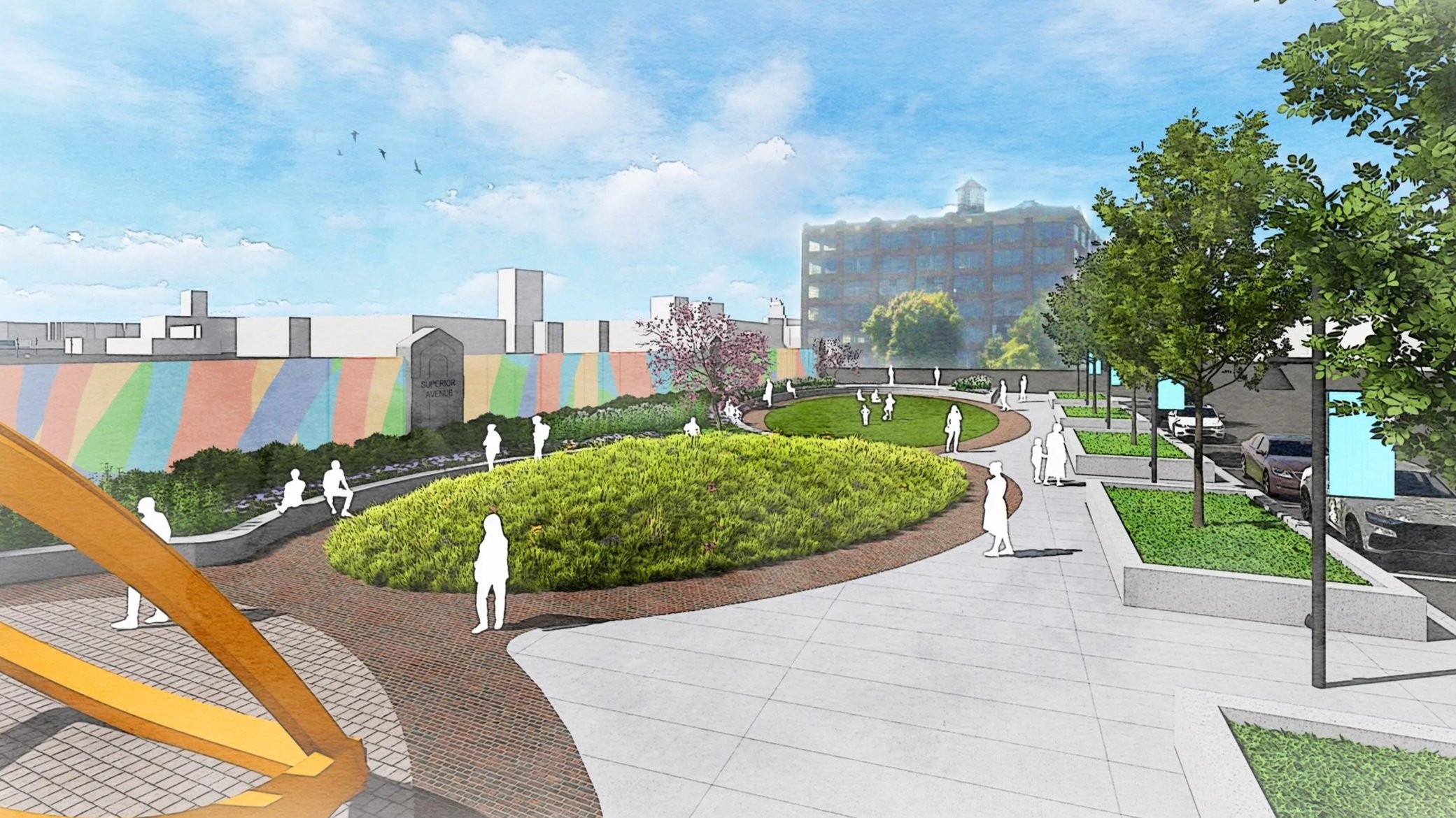
The Campus District in Downtown Cleveland, Ohio is a key downtown area defined by three anchor institutions: Cleveland State University (CSU), Cuyahoga Community College (Tri-C) Metro Campus, and the former St. Vincent Charity Medical Center. Located just east of the central business district along major corridors, this area is a dense, dynamic mix of educational institutions, social services, and businesses, drawing thousands of students, faculty, and workers daily. Recent and future developments have spurred the need to revitalize the area in order to attract mixed-use residential projects and street-level retail and to maintain access to critical social services. This area is a dynamic urban community that is well positioned to be a destination for living, working, and healing.
HOW
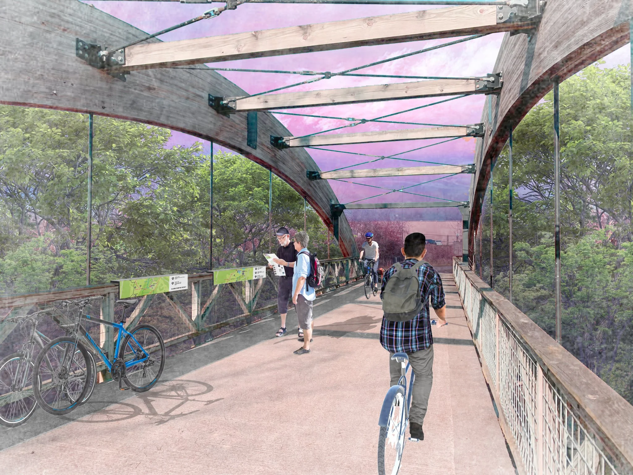
The Campus District Master Plan establishes a strategic framework for fostering a community of purpose, focusing on five key themes: safety, vibrancy, connectivity, restoration, and authenticity. This comprehensive approach is designed to drive economic growth and cultivate a neighborhood with attractive housing options, ultimately transforming the area into a more active and connected urban environment. Designing Local leveraged core themes to enhance the district’s historic character. Specific interventions to improve connectivity between key amenities at the north and south ends of this large urban area, create new public spaces like the Campus Trail and pocket parks, and identify public art and placemaking opportunities that will serve as catalysts for economic development and resident attraction. The plan’s initial objectives include refining zoning, simplifying the design review process, expanding historic tax credit opportunities, and strategically redeveloping marquee historic buildings to diversify the housing stock.
WHAT
The master plan prioritizes enhancing multimodal connectivity and revitalizing the public realm. Initiatives are focused on supporting small businesses, consolidating surface parking lots for future development, and implementing public art programs that will revitalize streetscapes and define new gateways at the eastern and western edges of the district. The ultimate goal is to create a well-connected and economically strong Campus District that celebrates its significant history while establishing itself as an iconic destination for residents and visitors of Downtown Cleveland.
Brunswick Parks & Recreation Master Plan
Brunswick, Ohio
WHY
When the City of Brunswick, Ohio emerged from a period of financial hardship to resume investing in community amenities, fiscally conservative city leaders wanted to ensure these investments would target their constituents' highest priorities. Their goal with the city's first-ever Parks & Recreation Master Plan was to understand what community members wanted from their parks system and develop a responsible, measured approach to delivering it.
HOW
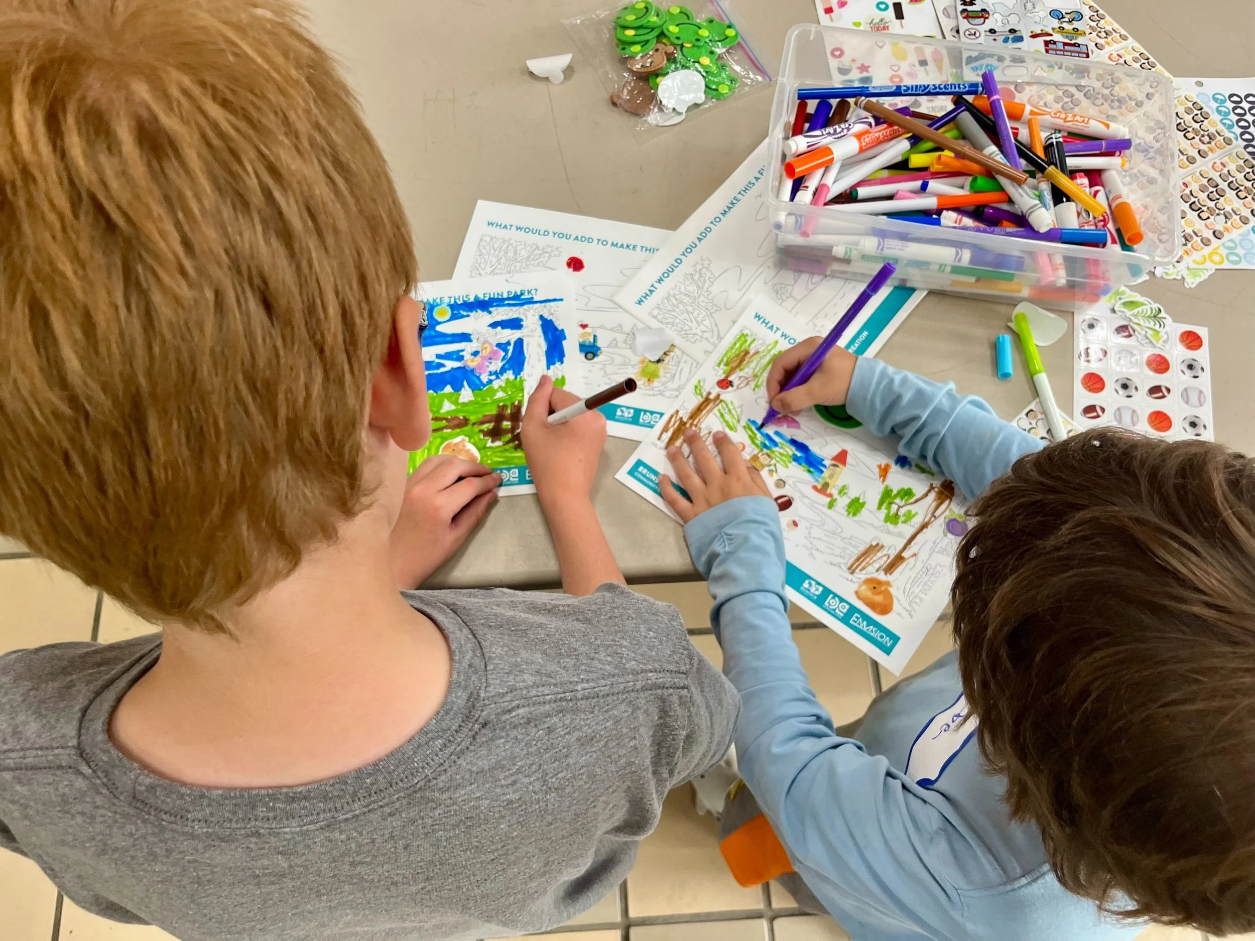
To ascertain Brunswick residents' parks-related needs and preferences, Designing Local conducted 17 stakeholder interviews, held 2 open house events, and offered an online survey to which almost 1,400 responded. Zec Eight Insights was enlisted in the planning process to conduct a benchmarking analysis that compared Brunswick's parks system with others of a similar size nationwide; Envision Group prepared a fiscal analysis and implementation plan to facilitate each recommendation.
WHAT
Brunswick's City Council discussed the plan in early 2025; at the same meeting, they recommended dedicating $1.2 million from the city budget to implement its recommendations.
Racine Riverfront Revitalization
Racine, Ohio
WHY
The Village of Racine seeks to revitalize their downtown area with riverfront access, improved walkability, and outdoor community gathering places. Racine leadership has sought for many years to increase access to their riverfront, but been stymied by regulations that restrict building along the Ohio River, and the expense of accommodating them.
HOW
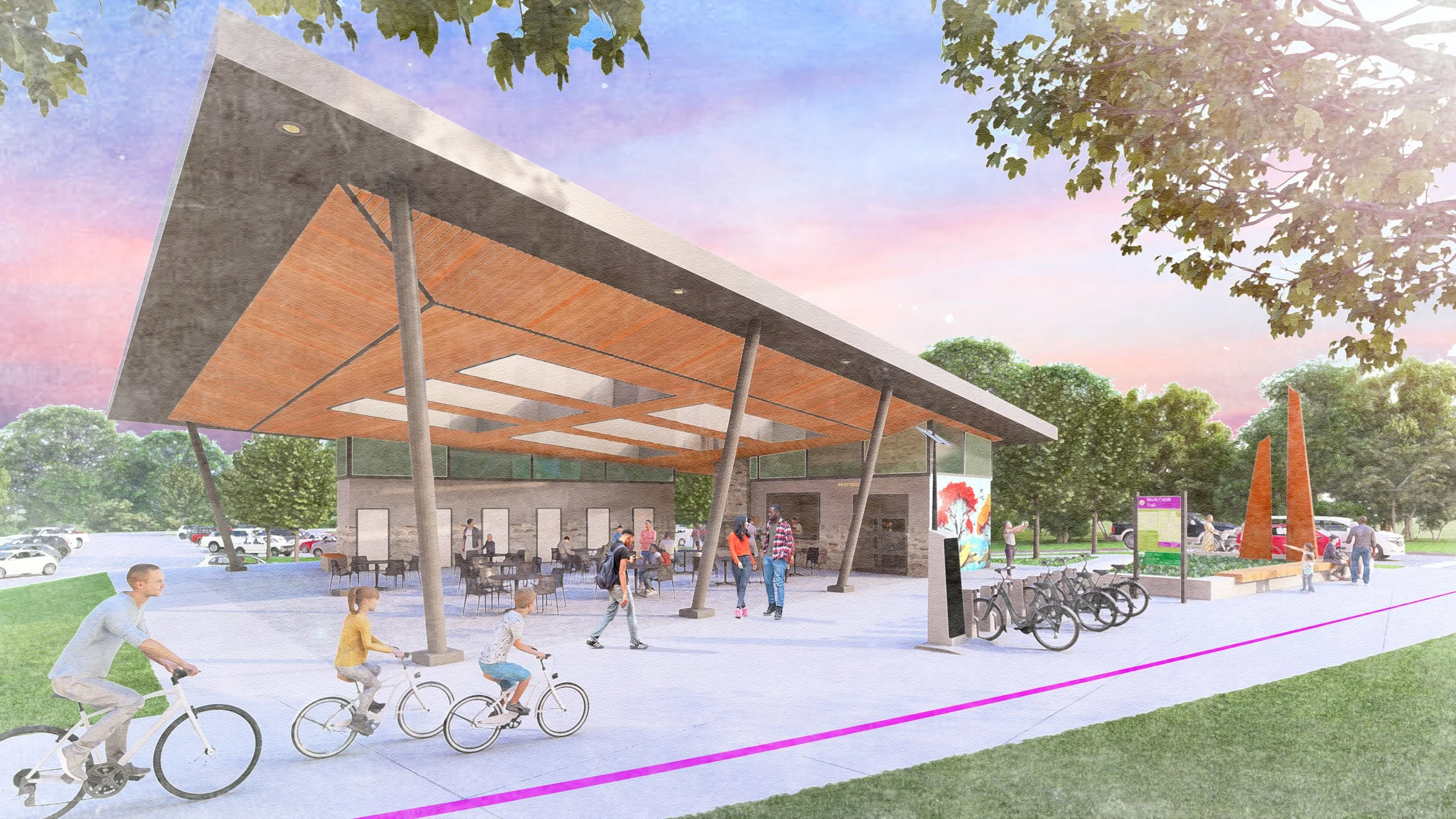
The focus of this project is to create riverfront access at Star Mill Park that includes walking paths (connecting the riverfront park to the Cross Building a short distance away), a community amphitheater, a recreational boat dock and kayak launch. It further includes streetscape improvements along 3rd and Pearl Streets to facilitate the creation of an outdoor business district, the focal point of which will be a pavilion for farmer’s markets and musical performances, among other community events.
WHAT
This project will provide Racine citizens with opportunities for outdoor wellness activities, including walking and a farmer’s market, that promote active lifestyles and social interaction. The project is currently in design.
Marsh Park Master Plan
Fairfield, Ohio
WHY
Fairfield, Ohio first leased a portion of the Martin Marietta/Dravo Quarry for the Thomas O. Marsh Park property in 1978; since then, the park has grown to be 146 acres, including a 60-acre lake. Marsh Park serves as a crucial recreational area for the community, offering both passive natural elements and outdoor activities. In 2016, the City completed its first Master Plan for the site, which laid the foundation for future development and improvements. Fairfield’s City Council has continued to prioritize Marsh Park as a significant asset for the city, highlighting the property’s intrinsic value, natural beauty, and potential for development.
HOW
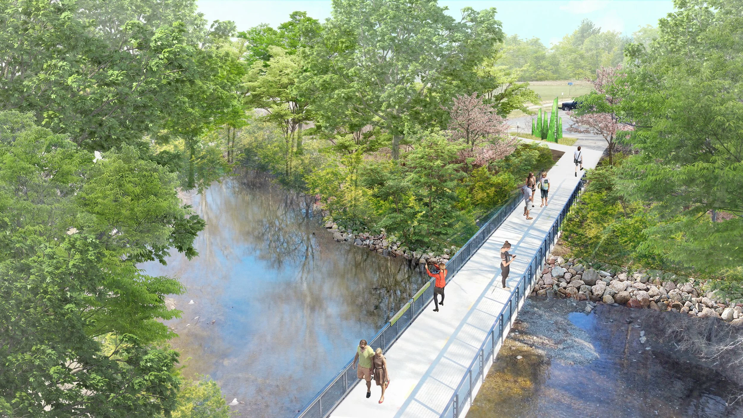
Designing Local offered planning solutions and visualizations, grounded in community feedback and technical analysis, that cast a compelling vision for what this park could become — a regional trail hub with expanded uses and access for both community members and trail travelers.
WHAT
In early 2025, Designing Local finalized an updated Marsh Park Master Plan that will further enhance the park’s natural environment, promote connections between the park and its users, foster community through events and programming, and provide access to amenities that encourage recreation.
Fairfield Town Center Placemaking Strategy
Fairfield, Ohio
WHY
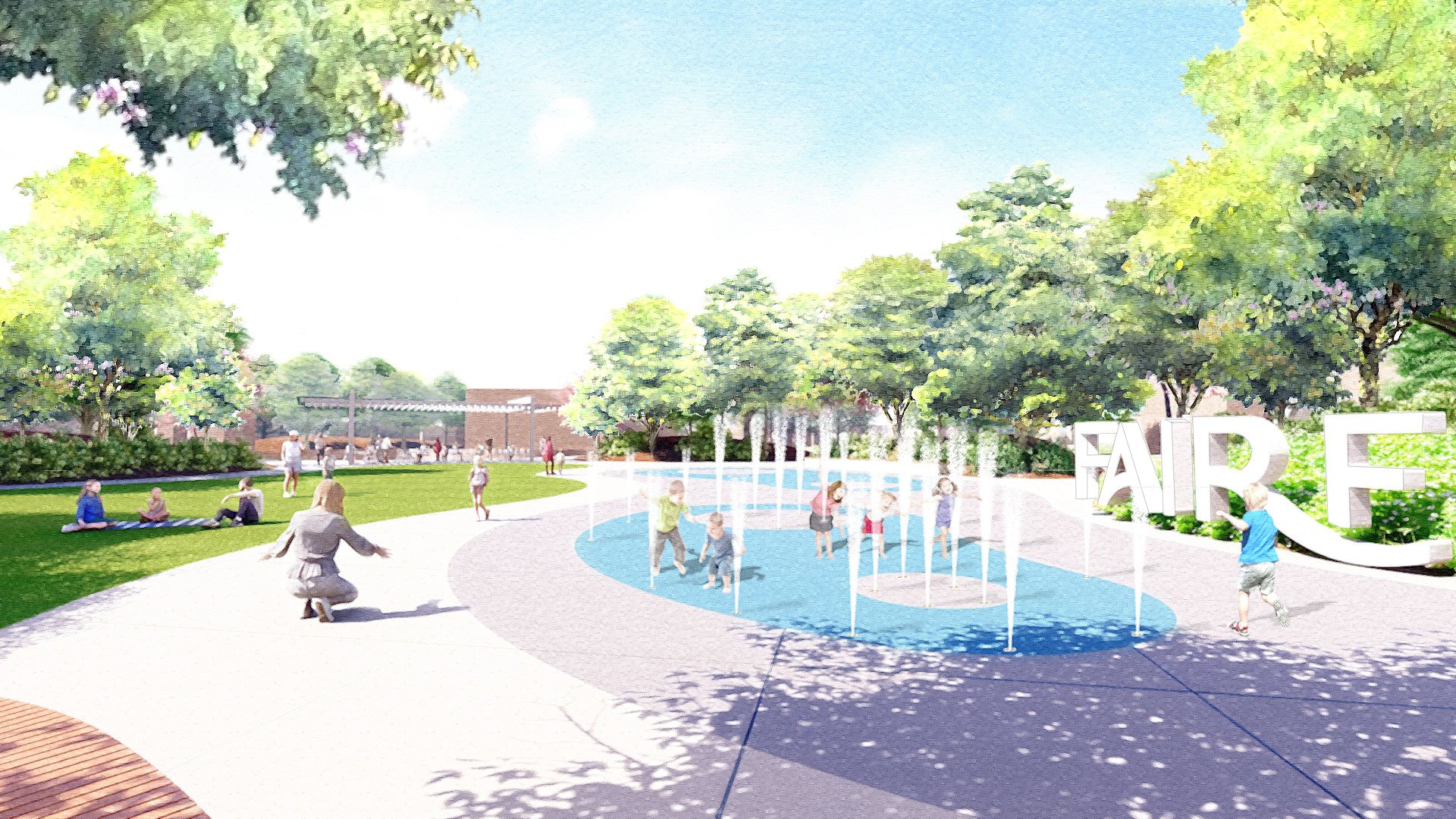
The Fairfield Placemaking Strategy tackles the revitalization of the Fairfield Town Center. The Fairfield Placemaking Strategy was developed through a collaborative process involving community members, business owners, and local officials. The team conducted extensive research, including surveys, interviews, and site visits, to identify the unique assets and challenges of the Town Center.
HOW
Through the planning process Designing Local developed recommendations that focus on incorporating placemaking principles to cultivate a welcoming and lively atmosphere. This includes improvements to signage, pedestrian accessibility, and public spaces, along with considerations for infill development that aligns with the town’s brand identity.
WHAT
By implementing these suggestions, the Fairfield Town Center aspires to become a central point for commerce and a gathering place for residents of all ages and backgrounds. The plan was completed in April 2024. This project demonstrates Designing Local’s ability to provide a guide for transforming the area into the vibrant hub of the community.
Rickenbacker Woods Park
Columbus, Ohio
WHY
This project will create site development elements for the Rickenbacker Woods Foundation including various interpretive features and site infrastructure to support events, visitation, and other activities. The ‘Captain Edward V. Rickenbacker House’ is a National Historic Landmark, one of only three in Franklin County (Ohio Statehouse & Ohio Theatre). The site also honors Granville T. Woods, a world renowned African American scientist and inventor. He invented several items which allowed for safer electric railways and other public uses of electrical power. He is a member of the National Inventors Hall of fame.
HOW
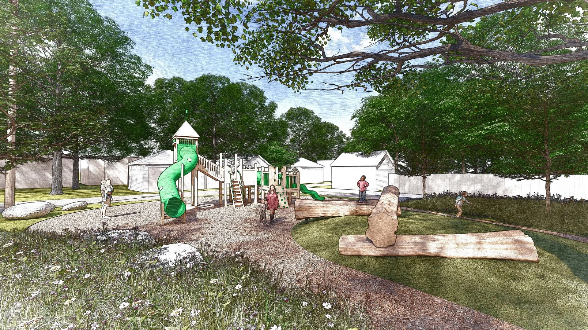
The Rickenbacker Woods Foundation strives to ignite the spirit of innovation and perseverance embodied through the lives and legacies of Capt. Eddie Rickenbacker and Granville T. Woods. This new park project will transform an existing site to provide youth access to pathways, play area, interpretive features, landscaping and site elements.
WHAT
The project is currently in design.
Downtown Clyde Revitalization Plan
Clyde, Ohio
WHY
The City of Clyde has a historic Downtown area with numerous buildings and public spaces that contribute to the character of the city center. Recognizing the importance of a vibrant downtown to Clyde’s identity and economic well-being, this plan proposes a series of strategic initiatives aimed at boosting the area’s attractiveness and functionality.
HOW
The plan goes beyond aesthetics – it also explores strategies to attract new businesses, enhances existing public spaces, and cultivates a dynamic mix of retail, dining, and entertainment options. By ensuring a diverse and thriving downtown core, the plan aims to create a hub for community activity and economic growth.
WHAT
This comprehensive proposal provides a framework for Clyde residents to shape the future of their downtown. The plan encourages community participation, fostering a sense of ownership and ensuring the revitalization efforts reflect the unique character and aspirations of Clyde. By working together, this plan gives the community a vision for transforming downtown Clyde into a vibrant place that serves as a source of pride and a catalyst for further development.
Central Ohio Greenways Wayfinding Strategy Guide
Central Ohio
WHY
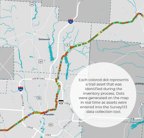
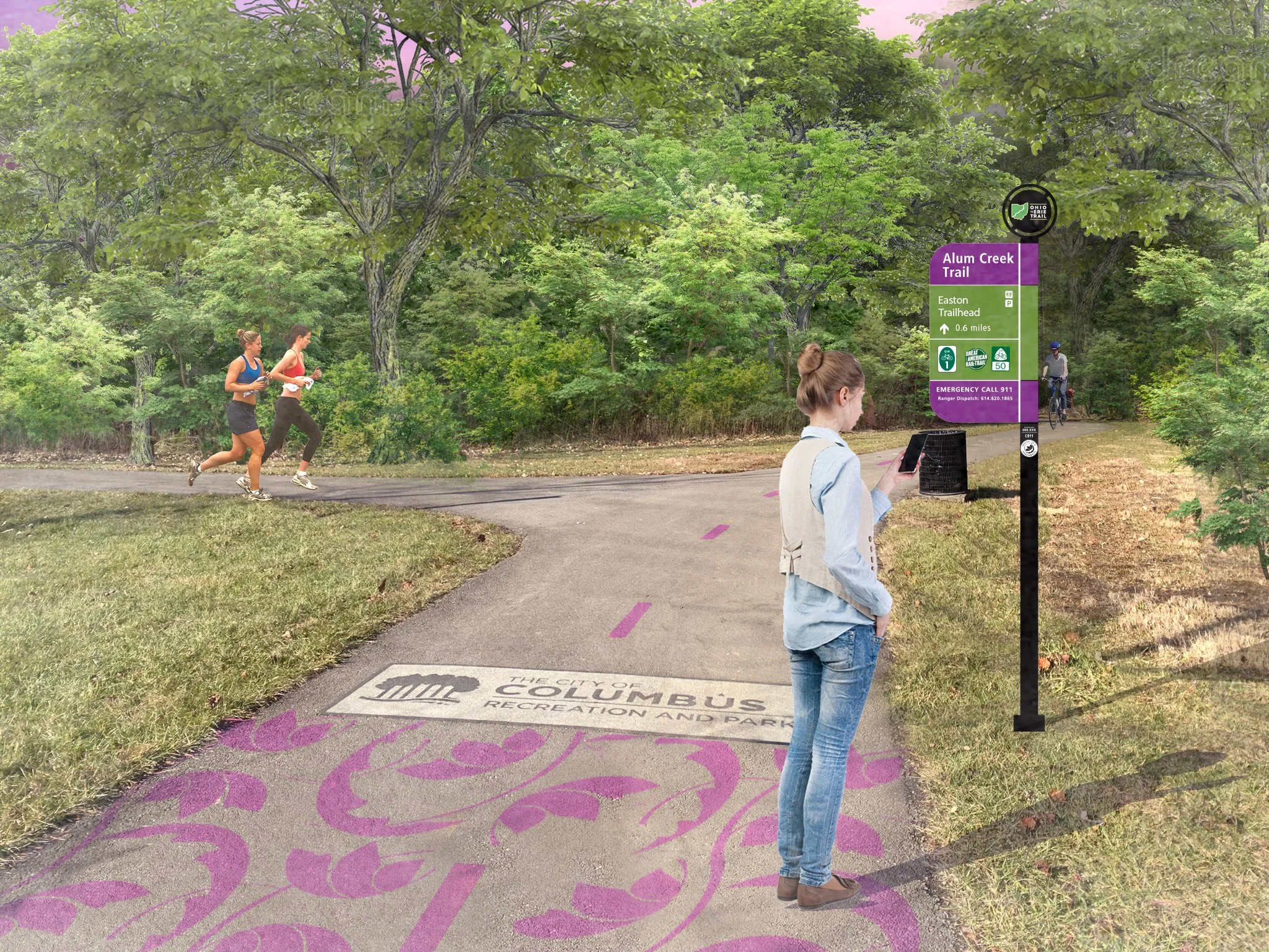
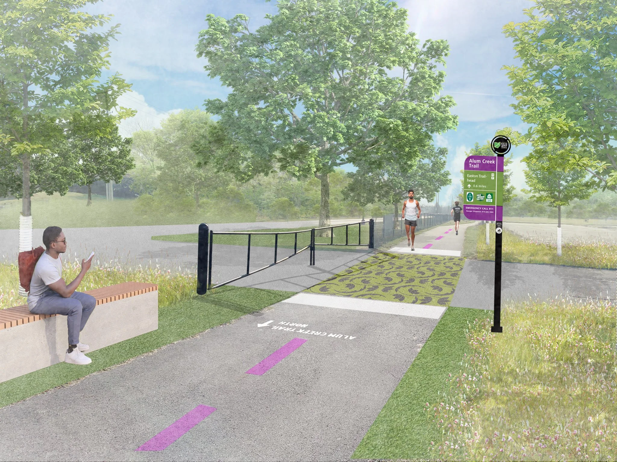
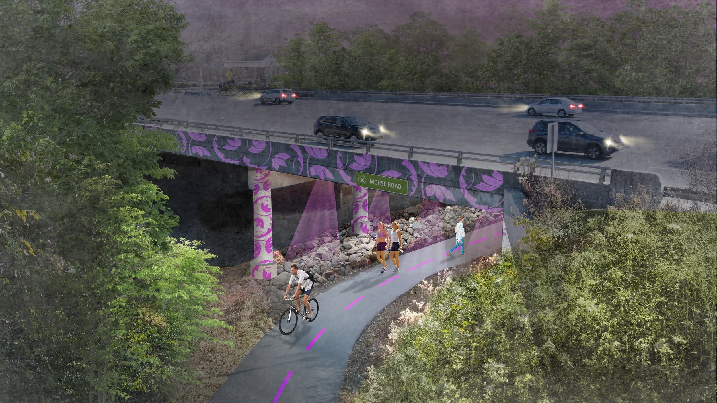
To accommodate the massive population growth expected in Central Ohio through 2050, the Central Ohio Greenways (COG) Board has committed to adding more than 500 miles of trails to its network. The Board has invested in professionally designed wayfinding signs and brand standards, but recognized a need to go further with its wayfinding strategy as it welcomes an influx of newcomers to the trails.
HOW
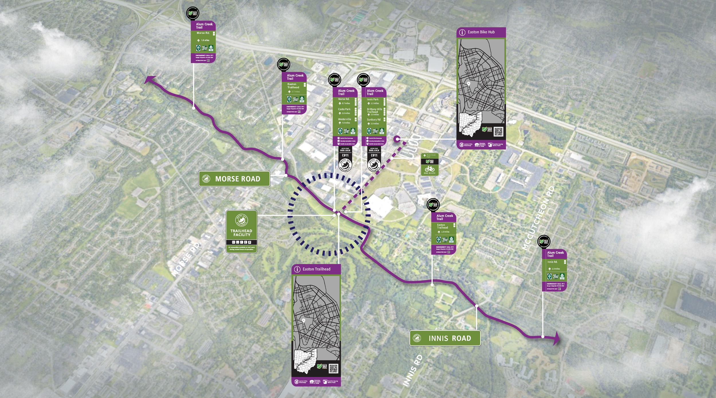
The COG Board selected for this project a segment of the Ohio to Erie Trail that runs through Madison County, Franklin County, Delaware County, and Knox County in Central Ohio. The intention is that the wayfinding strategy developed for this trail segment will be employed throughout the COG network and serve as a model for regional trail wayfinding across Ohio.
WHAT
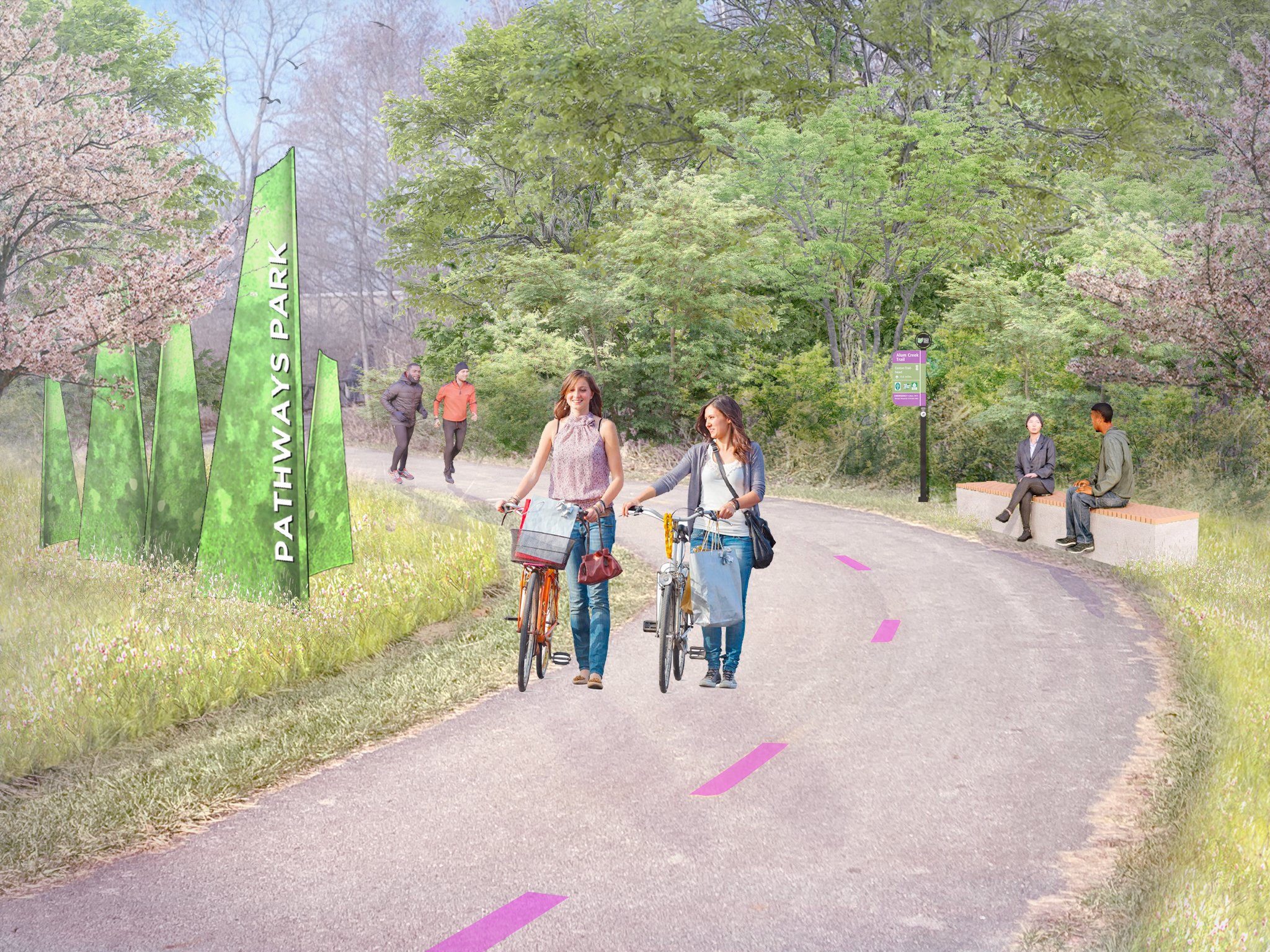
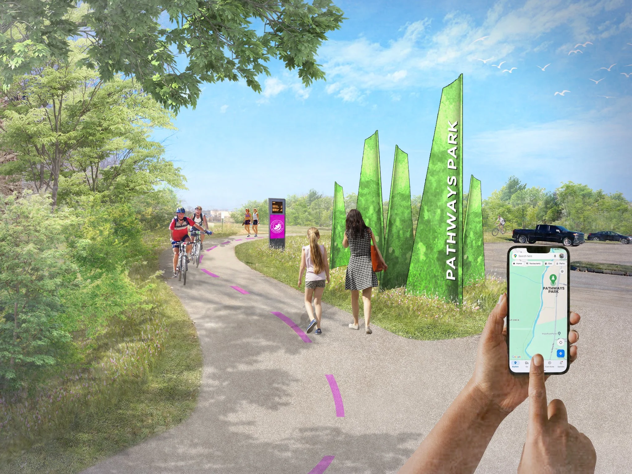
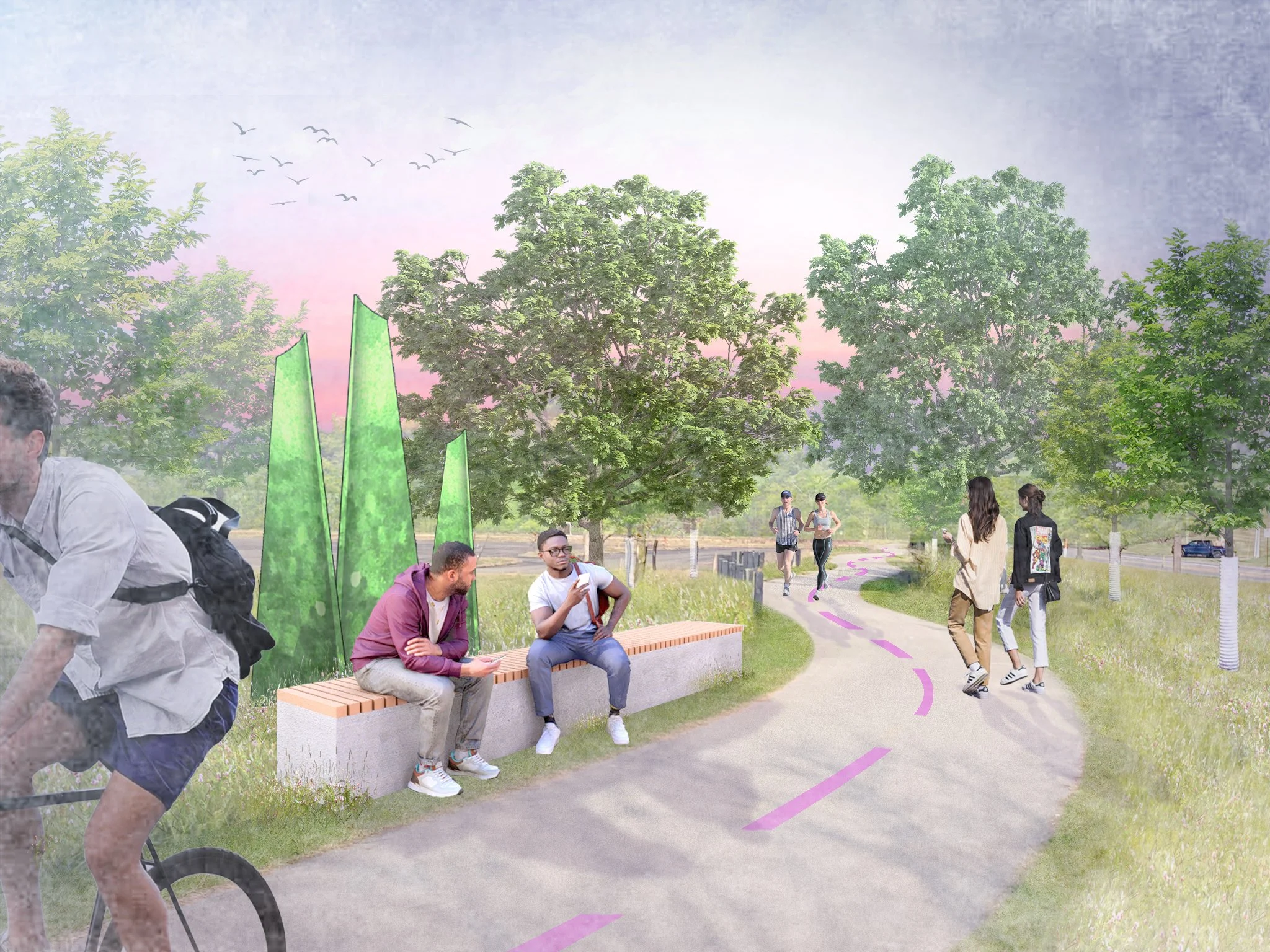
The Central Ohio Greenways Wayfinding Strategy Guide will honor the wayfinding investments communities have already made and provide additional strategies to make Central Ohio’s trails as easy to navigate as our roadways.
Fort Wayne 5-Year Parks & Recreation Master Plan
Fort Wayne, Indiana
WHY
The Indiana Department of Natural Resources (IDNR) requires park departments to produce a master plan every five years in order to be eligible for various grants and other funding resources. IDNR requires numerous elements to be a part of an approved report. This includes natural and landscape features, historical and cultural elements, social and economic factors, a supply analysis, ADA accessibility, public participation, and a needs analysis.
HOW
Designing Local and its partner Zec Eight Insights developed a master plan for Fort Wayne along with project partners New Haven-Adams Twp Parks & Recreation and Allen County Parks. The scope for all three projects includes stakeholder and public engagement, an overall park system assessment, and an inventory of each park. The final plan document for each park district is a cohesive document which communicates the current park system, the IDNR-required content, and the strategic implementation of the capital improvements over the next five years.
WHAT
Stakeholder meetings and a public open house were conducted throughout the Fall of 2022. A draft of the plan was submitted to IDNR in January 2023 with and the final plan was completed in May 2023.
New Haven- Adams Township 2023-2027 Parks & Recreation Master Plan
New Haven-Adams Township, Indiana
WHY
The Indiana Department of Natural Resources (IDNR) requires park departments to produce a master plan every five years in order to be eligible for various grants and other funding resources. IDNR requires numerous elements to be a part of an approved report. This includes natural and landscape features, historical and cultural elements, social and economic factors, a supply analysis, ADA accessibility, public participation, and a needs analysis.
HOW
Designing Local and its partner Zec Eight Insights developed a master plan for Fort Wayne along with project partners New Haven-Adams Twp Parks & Recreation and Allen County Parks. The scope for all three projects includes stakeholder and public engagement, an overall park system assessment, and an inventory of each park. The final plan document for each park district is a cohesive document which communicates the current park system, the IDNR-required content, and the strategic implementation of the capital improvements over the next five years.
WHAT
Stakeholder meetings and a public open house were conducted throughout the Fall of 2022. A draft of the plan was submitted to IDNR in January 2023 with and the final plan was completed in May 2023.
Allen County Parks 2023-2027 Parks & Recreation Master Plan
Allen County, Indiana
WHY
The Indiana Department of Natural Resources (IDNR) requires park departments to produce a master plan every five years in order to be eligible for various grants and other funding resources. IDNR requires numerous elements to be a part of an approved report. This includes natural and landscape features, historical and cultural elements, social and economic factors, a supply analysis, ADA accessibility, public participation, and a needs analysis.
HOW
Designing Local and its partner Zec Eight Insights developed a master plan for Fort Wayne along with project partners New Haven-Adams Twp Parks & Recreation and Allen County Parks. The scope for all three projects includes stakeholder and public engagement, an overall park system assessment, and an inventory of each park. The final plan document for each park district is a cohesive document which communicates the current park system, the IDNR-required content, and the strategic implementation of the capital improvements over the next five years.
WHAT
Stakeholder meetings and a public open house were conducted throughout the Fall of 2022. A draft of the plan was submitted to IDNR in January 2023 with and the final plan was completed in May 2023.
Belle Valley Revitalization Plan
Belle Valley, Ohio
WHY
Belle Valley is a village located directly on the alignment of I-77 and has a rich industrial history. Main Street is situated in the valley of West Fork Duck Creek and the village's housing and other buildings are built on the surrounding hillsides.
The community has an existing historic church that was recently listed on the National Register of Historic Places. The church has not been occupied for several decades and requires significant improvements. The Village desires to renovate the space for use as a community center and event space.
HOW
Building on the brand identity developed for neighboring Caldwell, Ohio, Designing Local worked with Village leadership to create a brand identity for Belle Valley that highlights the church as a community icon. This provided the starting point for various signage and placemaking features that will be implemented throughout the community.
WHAT
A key recommendation of the plan is a major streetscape improvement project that will add decorative lighting, site furnishings, and sidewalks. This project will also improve ADA Accessibility, traffic management, and stormwater drainage.
Buckeye Hills Regional Council Downtown Workshops
Buckeye Hills Region, Ohio
WHY
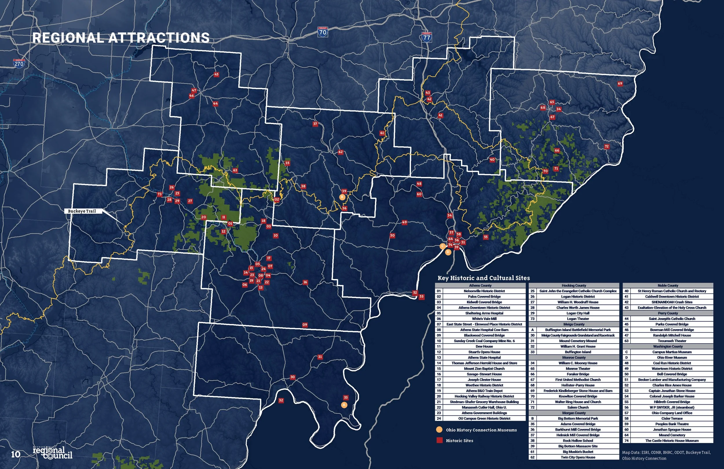
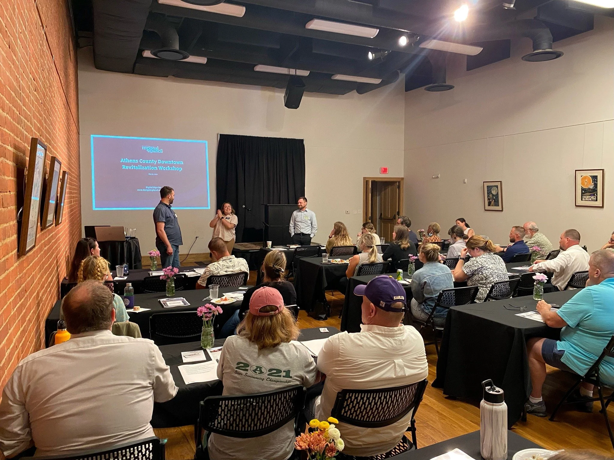
Following on the announcement of a historic $500 million investment in Appalachian Ohio by Governor DeWine's administration, Buckeye Hills Regional Council partnered with Designing Local to host a series of eight workshops aimed at helping communities reimagine their downtowns.
Buckeye Hills Regional Council and Designing Local are excited to help communities translate their vision into a unique, interesting, and powerful built environment through these workshop sessions.
HOW
The series was free and open to all Southeast Ohio community leaders, elected officials, nonprofits, and anyone working to make their community a better place to live, work and play. Each workshop covered the topics of Outdoor Recreation, Historic Preservation, Public Art, Streetscapes, Pedestrian Infrastructure, and more. Designing Local helped guide communities through the best practices of developing both small- and large-scale revitalization projects.
WHAT
Following the completion of the workshops Designing Local created a workbook intended to assist folks within the Buckeye Hills region to develop projects.
Marysville Five Points Concept Study
Marysville, Ohio
WHY
The City of Marysville has a beautiful historic downtown and significant new commercial and industrial development. While this growth is welcome, it is creating development pressure in culturally and aesthetically important areas of the community.
The Five Points area of Downtown is the fulcrum between highway-oriented development and the historic urban Downtown. This area currently has a number of fast-food restaurants, strip centers, and gas stations intermingled with historic homes and commercial buildings. Developers are purchasing both historic and non-historic properties for redevelopment and are proposing inappropriate development for this area.
HOW
The City requested this project to have a quick production schedule in order to influence current development proposals. Two concept plans were provided which demonstrate different strategies to handle infrastructural modifications. The City of Marysville staff and Designing Local participated in a charrette to develop preliminary approaches to development types, traffic movements, open space enhancements, and shared use trail enhancements.
Using this as a starting point, the Design Team created site plan sketches, development benchmarks, and a summary document to communicate the future development intent for this area.
WHAT
The concepts are being used by the City of Marysville to guide new development in the study area. During the conceptual review process, City staff utilizes the concepts to demonstrate the overall vision for the study area and how each individual development is able to support this vision.
Ohio & Erie Canal Southern Descent Heritage Trail
Various Sites Throughout Central And Southern Ohio
WHY
The Canal Partners is a coalition of communities in Southern Ohio along the alignment of the Southern Descent of the Ohio & Erie Canal. These communities have existing and lost features of the canal, as well as numerous related historical elements.
The goal of the Canal Partners is to create a heritage trail that will attract tourists throughout the corridor and to communicate the history of the canal system to a broad audience.
HOW
This grant-funded project included several team members including the project leaders, a graphic design consultant, the partner communities, and Designing Local.
The first phase process included engagement of the Canal Partners through workshops and a survey. This phase also included mapping of the resources and other sites along the trail. Once this was completed, a highly visual plan booklet of the sites was created which included descriptions of the various elements as well as a prototype trailhead design. Part of the project study will included bike and pedestrian trail connections to the canal right-of-way.
WHAT
The end product is being used by the partner communities in their planning and capital improvement projects for the next several years. The mapping will be used by tourists to experience the canal features. The project was completed in summer 2021.
Lockbourne Veterans Park
Lockbourne, Ohio
WHY
Lockbourne is located south of Columbus and has a charming collection of historic homes and buildings. The Village is taking steps to capitalize on various resources including several canal locks and a major stream corridor.
The Village planned to utilize an open lot adjacent to its Town Hall as a site for a new Town Green that will include a new Veterans Memorial, a performance pavilion, plantings, and various amenities. The Town Green will become the focal point of future community events.
HOW
Designing Local worked with Village leadership to develop a working concept which was used to solicit feedback from various community stakeholders. Adjustments to the original concept were made and multiple variations of various design elements were created.
In addition, the plan included an integrated plan for phasing. The Veterans’ Memorial were constructed first and the remaining elements were constructed when funds become available. The plan allows for the Town Green to function with only some elements complete or as a fully realized plan.
WHAT
The park had its grand opening on November 10, 2021, and included a substantial Veterans Day celebration. The park will be utilized for both Memorial Day and Veterans Day celebrations going forward.
Columbus Urban Forestry Master Plan
Columbus, Ohio
WHY
Falling short of its peer cities, the City of Columbus has an urban canopy coverage rate of only 22%. This results in numerous social and environmental impacts such as increased urban heat island effect, reduced property values, and disparities in social equity between Columbus neighborhoods. This project works to diagnose the problem and to determine potential solutions to increase the urban canopy on both publicly and privately-owned property.
HOW
A multi-disciplinary consultant team is currently completing a public engagement and background research process that will serve as the basis for the development of recommendations and action steps.
Designing Local is providing visual communication design services and public engagement support. Several educational pieces have been produced including an infographic package, presentation boards, slideshow presentation, and a website. The plan itself is a visually rich document with over 150 pages of content.
WHAT
A complete draft of the plan is currently out for review by the general public and various stakeholders. The public comments will be collected and incorporated into the final draft which is expected to be complete by late Spring 2021.
Downtown Caldwell Revitalization Plan
Caldwell, Ohio
WHY
Downtown Caldwell was recently listed on the National Register of Historic Places, and is now working toward a renaissance. With numerous local businesses and an assortment of beautiful historic buildings, Caldwell is ready to be a thriving center for both local residents and tourists. This plan builds upon the village’s momentum to create a number of recommendations for community branding, historic preservation development, placemaking, wayfinding, access to recreational facilities, and other improvements.
HOW
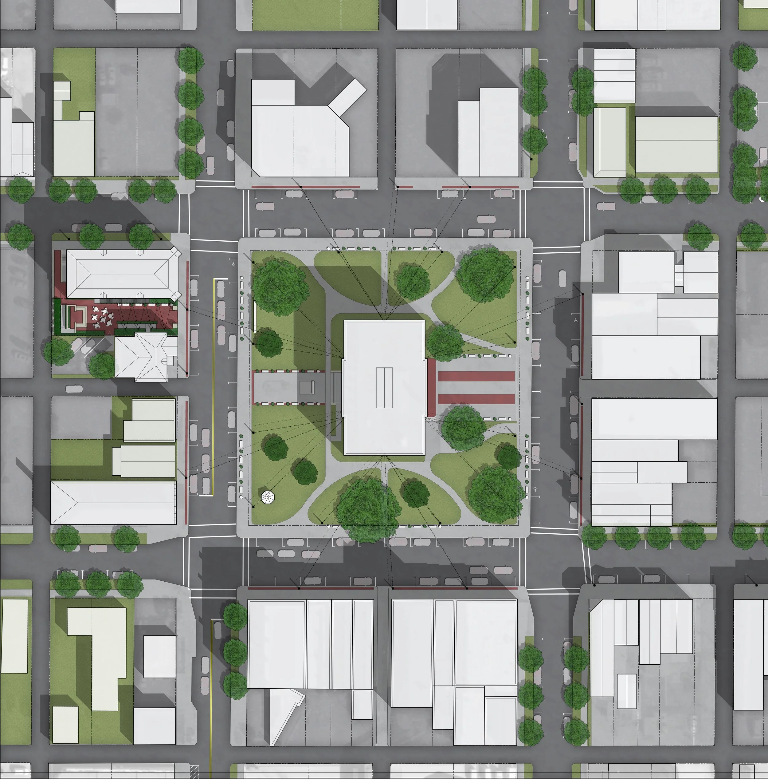
Designing Local first worked with village leadership to develop a brand identity for Caldwell. We then made a number of recommendations for relatively low-cost, high-impact placemaking opportunities, including a courthouse square light canopy, unique signage, historically appropriate site furnishings, and locations for public art. Working with our project architect, Designing Local also created a historic preservation recommendations for one of the most visible buildings in downtown, which included a strategy for attaining a Historic Tax Credit to make the project financially viable.
WHAT
The project plan was completed in Spring 2022. The new brand identity was immediately implemented, and the various project recommendations will be submitted as appropriate for federal stimulus and infrastructure funds.
Cape May County Creative Placemaking Plan
Cape May, New Jersey
WHY
In 1989, Cape May County initiated a taxpayer-funded program to purchase or protect open space and farmland throughout the County. The program proved successful and was eventually expanded to include funding of parks, recreational amenities, and historic preservation projects. While the program has been extremely successful in meeting its mission, it has relatively low public recognition.
HOW
To build awareness of the program and to increase the quality of funded projects, the County initiated a Creative Placemaking Plan which created a brand identity, standards for park design elements and amenities, and a demonstration site design. Designing Local was selected through a competitive process to lead the creative placemaking plan. The team facilitated four total workshops to garner input from key stakeholders and to develop and test ideas.
WHAT
A key part of the process was the creation of a community character framework which defines the unique sense of place present in Cape May County. This was utilized to drive the creation of the brand identity guidelines. The community character framework was also utilized in the design of various signage, site amenity, and architectural concepts throughout the County.
Plain City Survey on the Future
Plain City, Ohio
WHY
Plain City’s Comprehensive Plan Committee wanted to survey residents and other community stakeholders to uncover their vision for the village’s future and establish a baseline of their opinions to help shape the Plain City Comprehensive Plan.
HOW
Designing Local worked to gain widespread community participation in the ‘Survey on the Future’ by distributing business cards about it at the 4th of July and Steam Threshers parades and posting door tags on homes throughout the village. More than 600 village residents and 400 other stakeholders ultimately took the survey — a far greater response than had previously been achieved.
WHAT
The results were compiled into a ‘Survey on the Future’ final report, which was presented to Council and also released to the public.
