
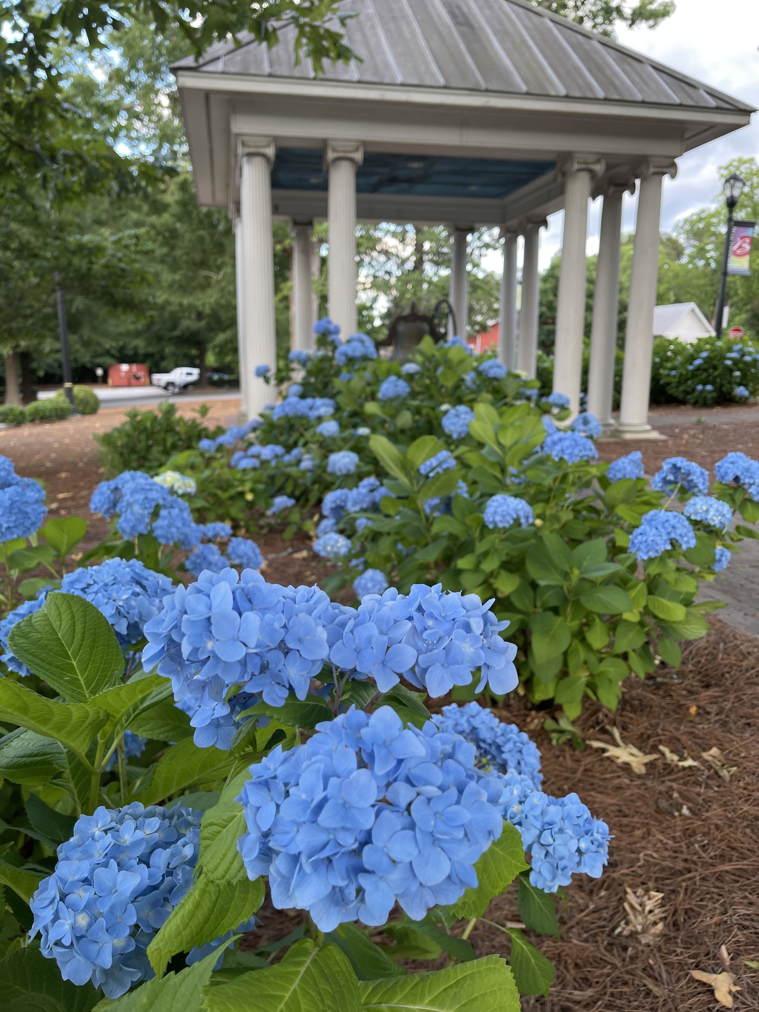
Hiawassee Public Art Strategy
Hiawassee, Georgia
WHY
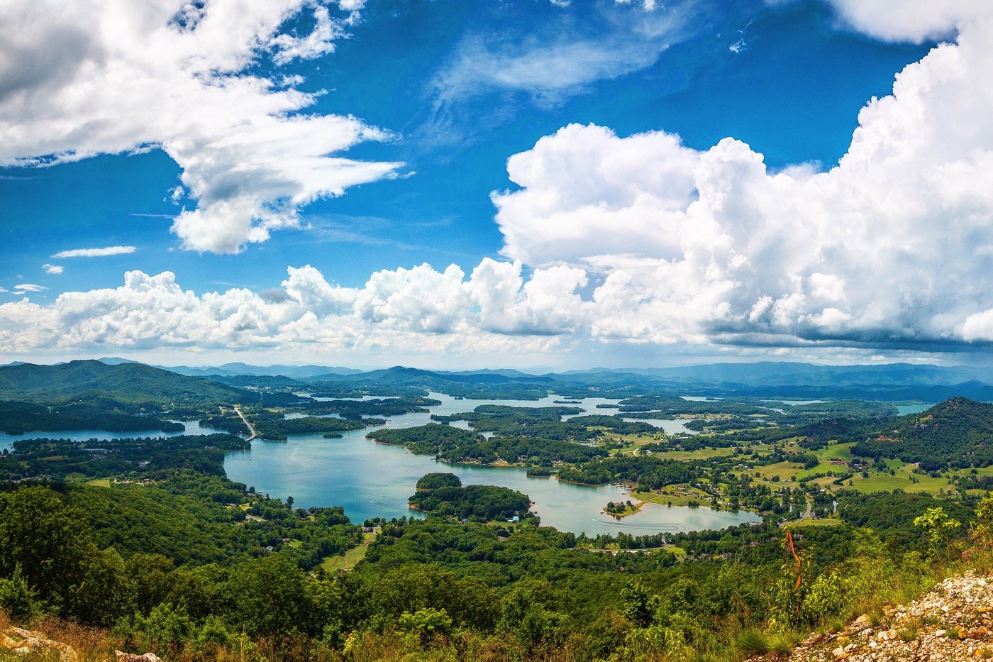
Hiawassee, Georgia’s lake and mountain paradise, is located on Lake Chatuge and is the seat of Towns County. To support this beloved outdoor destination and burgeoning arts scene, the Hiawassee Downtown Development Authority envisioned a plan that would support the next step in building Hiawassee’s identity as a place that cares about creativity and strategically invests in art that aligns with its rural, lake, and mountain character, honoring the Appalachian history and traditions and embracing a future that is accessible for all.
HOW
This plan lays the foundation for the future of public art in Hiawassee and prepares the City to expand its public art efforts, ensuring the physical environment reflects the art-focused culture of its residents and visitors. Future public art in Hiawassee will be a tool to represent the past, present, and future of Hiawassee.
WHAT
The Plan lays out specific projects that Hiawassee can implement over the next 5 years in a range of cost and scale.


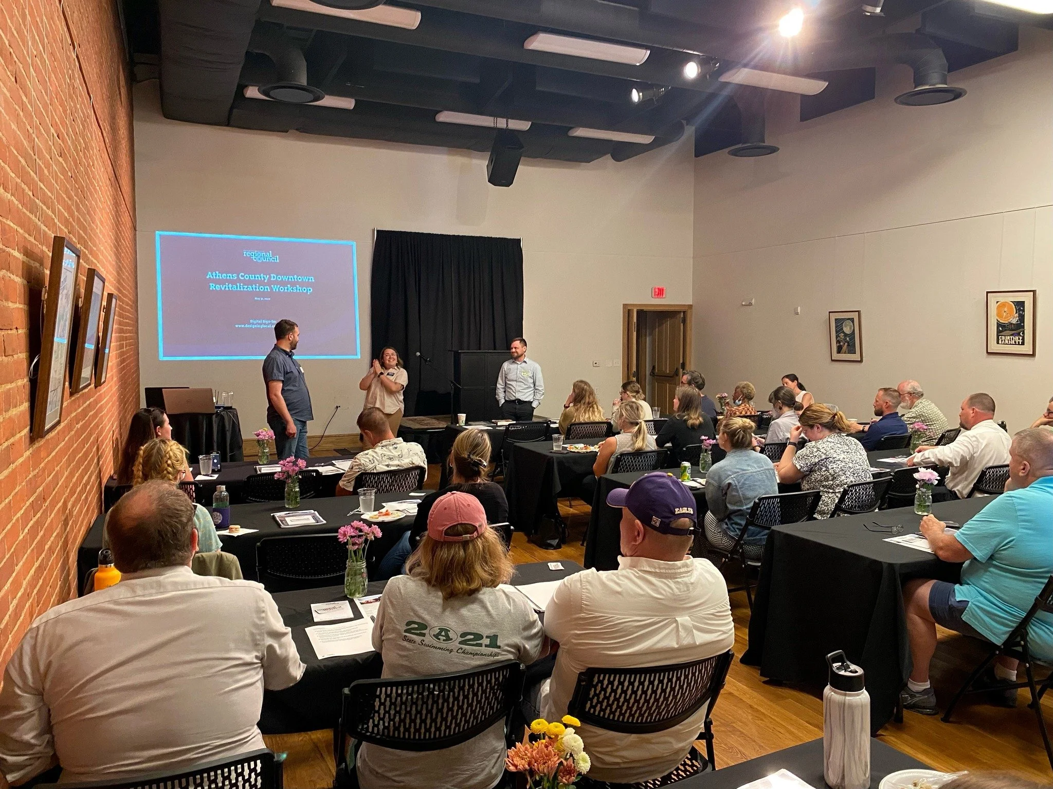
Buckeye Hills Regional Council Downtown Workshops
Buckeye Hills Region, Ohio
WHY
Following on the announcement of a historic $500 million investment in Appalachian Ohio by Governor DeWine's administration, Buckeye Hills Regional Council partnered with Designing Local to host a series of eight workshops aimed at helping communities reimagine their downtowns.
Buckeye Hills Regional Council and Designing Local are excited to help communities translate their vision into a unique, interesting, and powerful built environment through these workshop sessions.
HOW
The series was free and open to all Southeast Ohio community leaders, elected officials, nonprofits, and anyone working to make their community a better place to live, work and play. Each workshop covered the topics of Outdoor Recreation, Historic Preservation, Public Art, Streetscapes, Pedestrian Infrastructure, and more. Designing Local helped guide communities through the best practices of developing both small- and large-scale revitalization projects.
WHAT
Following the completion of the workshops Designing Local created a workbook intended to assist folks within the Buckeye Hills region to develop projects.


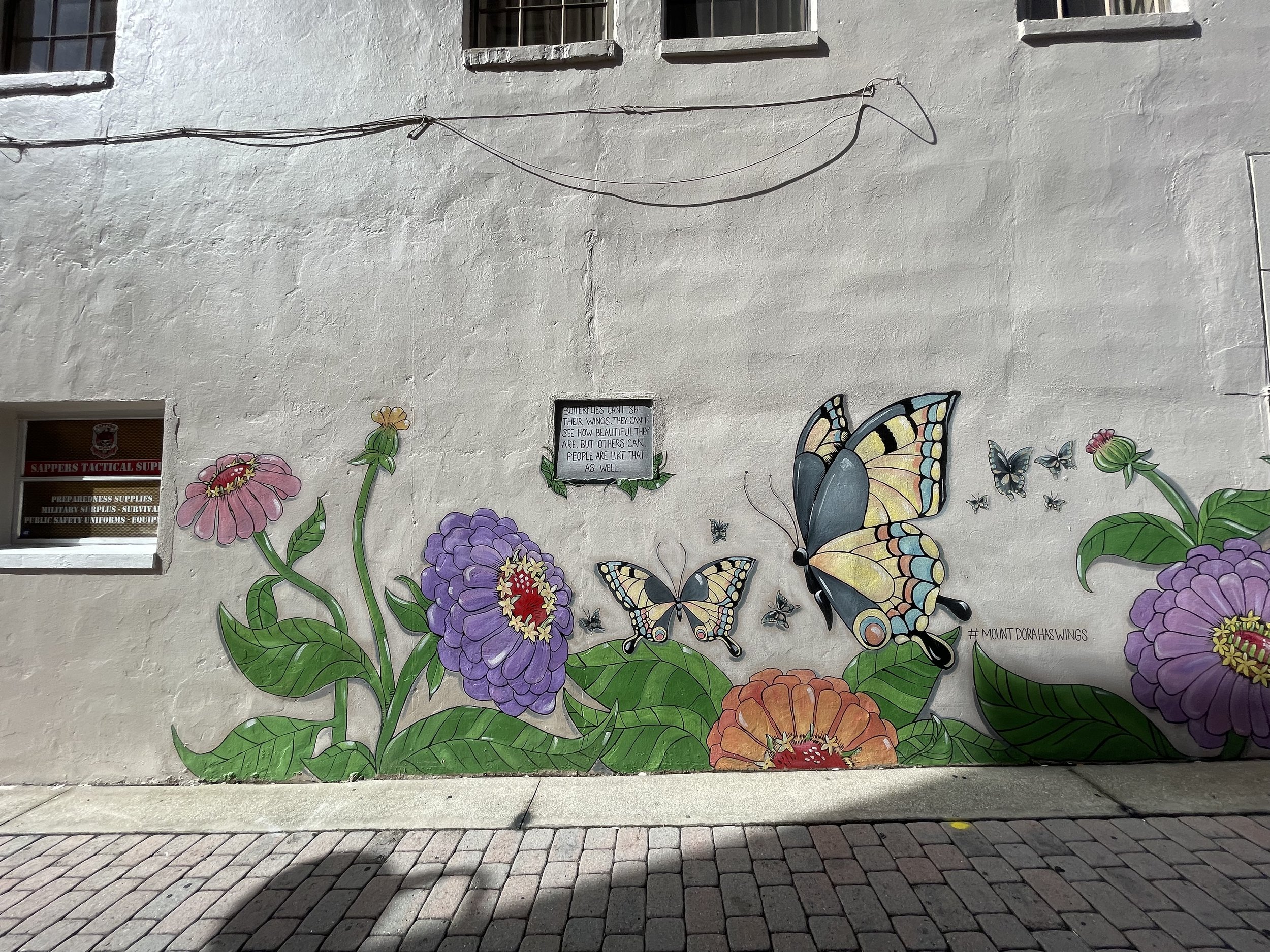
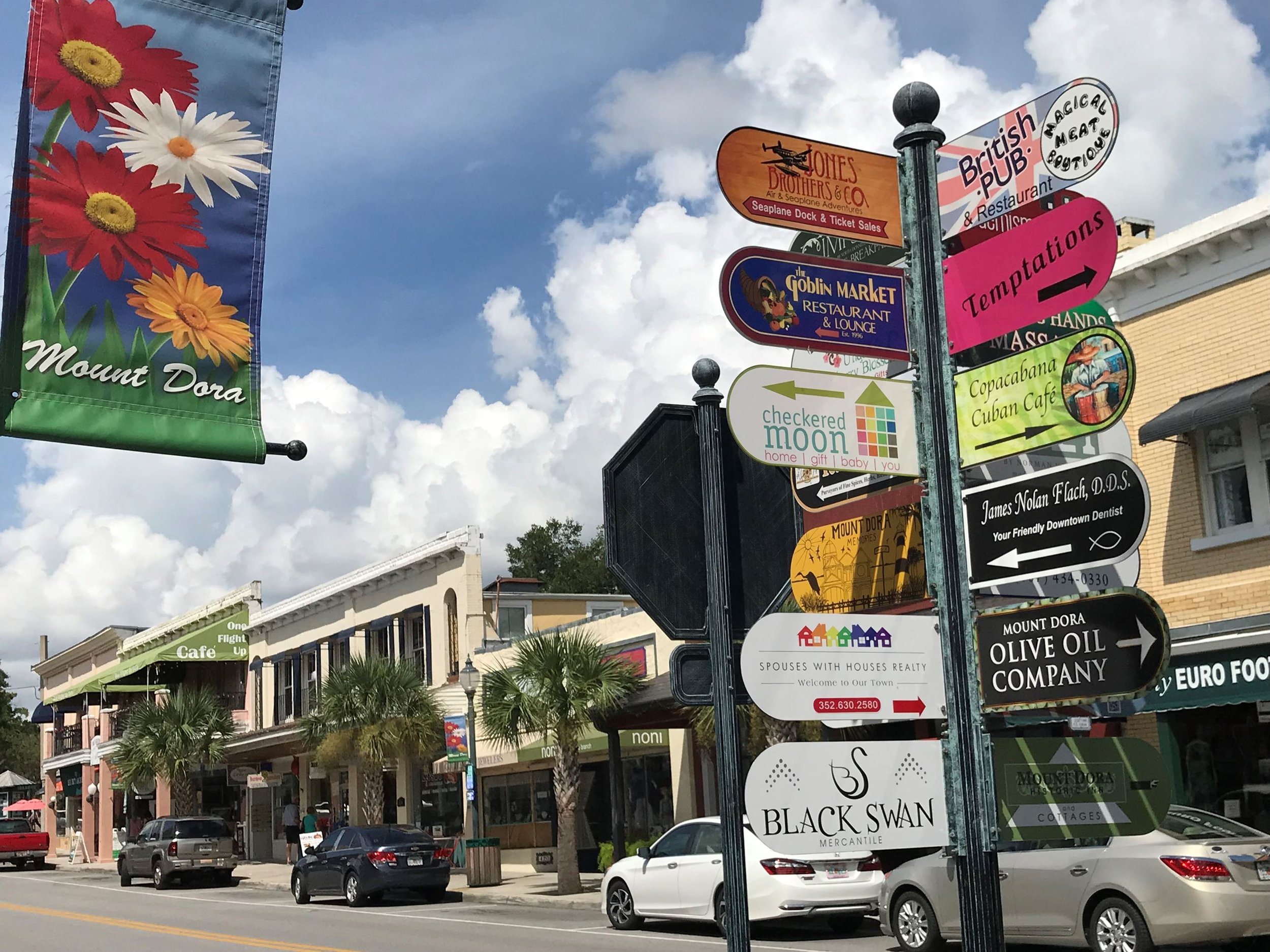
Mount Dora Public Art Plan
Mount Dora, Florida

WHY
Mount Dora stands on its own as a unique historic and arts focused community in Central Florida. The City of Mount Dora has an interesting legacy and connection with Scottish culture. Tree-lined streets and quaint historic buildings conceal a deep love for the arts in the community that bursts into display during the special events that take place in the community, many of which are art focused. In Mount Dora public art will help the physical environment come alive with the spirit of the community.
HOW
Discussions between the project team and community stakeholders formed the basis of the project team’s understanding of the City and of efforts to revitalize Mount Dora. The project team conducted a tour of the community as well as follow up visits to collect information and ideas. We found that community members love the unique small town historic charm of Mount Dora and revealed a desire to continue to enhance performing arts. There are also fantastic opportunities to connect performing and public art. One recommendation was the creation of a public art trail that would connect many of these sites, some of which already feature public art.
WHAT
The Mount Dora Public Art Plan lays the foundation for the future of public art in the City and prepares for expansion of the existing public art efforts to help ensure that the physical environment reflects the art focused culture of its residents and visitors. The Public Art Plan includes five unique design inspiration sections that can be used by artists to gain insight when creating pieces for Mount Dora. By strengthening the public art program, Mount Dora is one step closer to delivering on the vision of the community to see a wide variety of high quality public art from artists with various backgrounds.

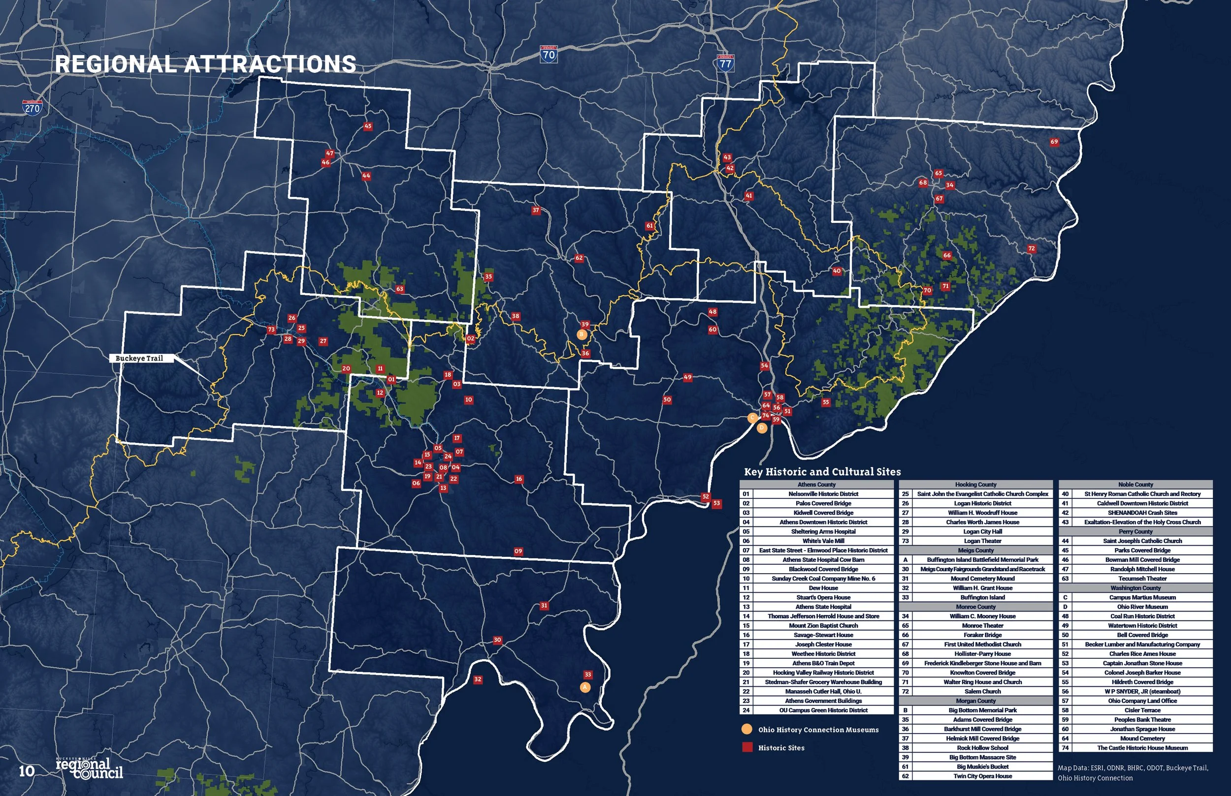
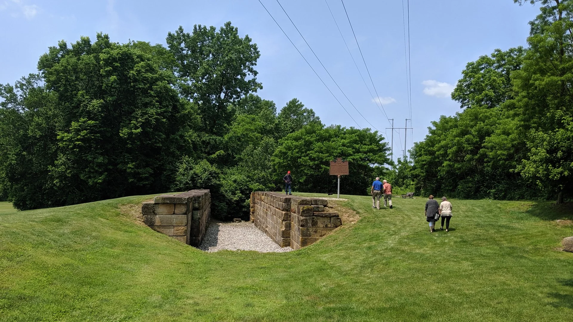
Ohio & Erie Canal Southern Descent NRHP Nomination
Various Sites Throughout Central And Southern Ohio
WHY
The Ohio & Erie Canal was originally constructed in the 1820’s and 1830’s and conveyed goods from Portsmouth to Cleveland. The canal system played a critical role in the early development of Ohio and established the growth of Akron, Columbus, Chillicothe, Newark, and numerous other cities along the route. The canal system was the key transportation system up until the proliferation of railroads in the 1860’s.
Although parts of the canal are on the national register, much of the southern portion is not. This nomination covers many of the lock structures and other remaining infrastructure that remain on the southern descent between Columbus and Portsmouth.
HOW
The nomination team aggregated a list of potential infrastructure to be placed on the register and contacted private property owners or municipalities to seek support. The final list includes existing lock structures, watered canals, bridge abutments, and other elements that are located in 4 counties throughout Central and Southern Ohio.
Identifying the location for each of the elements included field visits and the use of high resolution aerial photography. A boundary was created for each element which will serve as the official historic site on the National Register of Historic Places.
WHAT
Given its geographic reach and broad collection of relatively small sites, this nomination was technically challenging. However, it serves as a model for other non-contiguous district nominations that preserve transportation, infrastructure, or other geographically complex historic sites.


Marysville Five Points Concept Study
Marysville, Ohio

WHY
The City of Marysville has a beautiful historic downtown and significant new commercial and industrial development. While this growth is welcome, it is creating development pressure in culturally and aesthetically important areas of the community.
The Five Points area of Downtown is the fulcrum between highway-oriented development and the historic urban Downtown. This area currently has a number of fast-food restaurants, strip centers, and gas stations intermingled with historic homes and commercial buildings. Developers are purchasing both historic and non-historic properties for redevelopment and are proposing inappropriate development for this area.
HOW
The City requested this project to have a quick production schedule in order to influence current development proposals. Two concept plans were provided which demonstrate different strategies to handle infrastructural modifications. The City of Marysville staff and Designing Local participated in a charrette to develop preliminary approaches to development types, traffic movements, open space enhancements, and shared use trail enhancements.
Using this as a starting point, the Design Team created site plan sketches, development benchmarks, and a summary document to communicate the future development intent for this area.
WHAT
The concepts are being used by the City of Marysville to guide new development in the study area. During the conceptual review process, City staff utilizes the concepts to demonstrate the overall vision for the study area and how each individual development is able to support this vision.


Ohio & Erie Canal Southern Descent Heritage Trail
Various Sites Throughout Central And Southern Ohio

WHY
The Canal Partners is a coalition of communities in Southern Ohio along the alignment of the Southern Descent of the Ohio & Erie Canal. These communities have existing and lost features of the canal, as well as numerous related historical elements.
The goal of the Canal Partners is to create a heritage trail that will attract tourists throughout the corridor and to communicate the history of the canal system to a broad audience.
HOW
This grant-funded project included several team members including the project leaders, a graphic design consultant, the partner communities, and Designing Local.
The first phase process included engagement of the Canal Partners through workshops and a survey. This phase also included mapping of the resources and other sites along the trail. Once this was completed, a highly visual plan booklet of the sites was created which included descriptions of the various elements as well as a prototype trailhead design. Part of the project study will included bike and pedestrian trail connections to the canal right-of-way.
WHAT
The end product is being used by the partner communities in their planning and capital improvement projects for the next several years. The mapping will be used by tourists to experience the canal features. The project was completed in summer 2021.


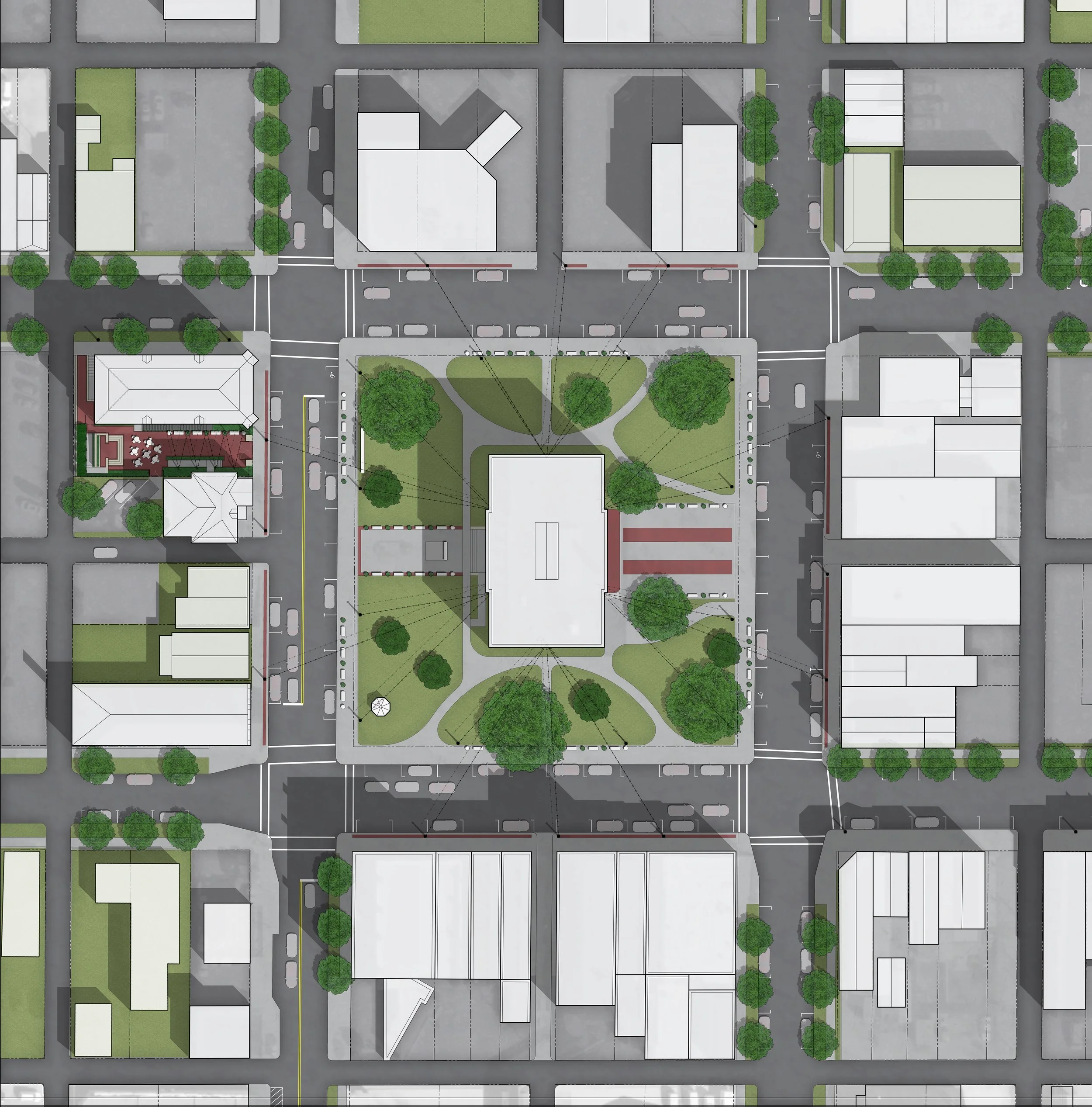
Lockbourne Veterans Park
Lockbourne, Ohio

WHY
Lockbourne is located south of Columbus and has a charming collection of historic homes and buildings. The Village is taking steps to capitalize on various resources including several canal locks and a major stream corridor.
The Village planned to utilize an open lot adjacent to its Town Hall as a site for a new Town Green that will include a new Veterans Memorial, a performance pavilion, plantings, and various amenities. The Town Green will become the focal point of future community events.
HOW
Designing Local worked with Village leadership to develop a working concept which was used to solicit feedback from various community stakeholders. Adjustments to the original concept were made and multiple variations of various design elements were created.
In addition, the plan included an integrated plan for phasing. The Veterans’ Memorial were constructed first and the remaining elements were constructed when funds become available. The plan allows for the Town Green to function with only some elements complete or as a fully realized plan.
WHAT
The park had its grand opening on November 10, 2021, and included a substantial Veterans Day celebration. The park will be utilized for both Memorial Day and Veterans Day celebrations going forward.


Columbus North High School
Columbus, Ohio

WHY
Columbus North High School was built in 1924 and is listed on the National Register of Historic Places. The structure was designed by notable Columbus architect Frank Packard in the Tudor Revival style and has a prominent position in Old North Columbus.
The school has served numerous purposes throughout its lifespan and was due for a major upgrade. Columbus City Schools selected an architect to work through the major changes which included preservation of various architectural elements. The existing athletic fields were not functioning properly to meet the planned use of the school.
HOW
Designing Local worked with the client team to determine the desired uses for the recreation fields and to develop a new configuration of various elements. Multiple options were created to encourage discussions with CCS facilities leadership and administrative staff. This included various configurations for OHSAA compliant fields, multiple locations for bleachers, fences, and other items, and removal or reconfiguration of existing lighting. Ultimately an option was selected which included a regulation middle school softball field and soccer field.
WHAT
Designing Local provided a schematic level plan which located and dimensioned the layout of various sports field reconfigurations. The plan was implemented through a design-build process and is currently in use by the school and the community.


Columbus Urban Forestry Master Plan
Columbus, Ohio

WHY
Falling short of its peer cities, the City of Columbus has an urban canopy coverage rate of only 22%. This results in numerous social and environmental impacts such as increased urban heat island effect, reduced property values, and disparities in social equity between Columbus neighborhoods. This project works to diagnose the problem and to determine potential solutions to increase the urban canopy on both publicly and privately-owned property.
HOW
A multi-disciplinary consultant team is currently completing a public engagement and background research process that will serve as the basis for the development of recommendations and action steps.
Designing Local is providing visual communication design services and public engagement support. Several educational pieces have been produced including an infographic package, presentation boards, slideshow presentation, and a website. The plan itself is a visually rich document with over 150 pages of content.
WHAT
A complete draft of the plan is currently out for review by the general public and various stakeholders. The public comments will be collected and incorporated into the final draft which is expected to be complete by late Spring 2021.


Chillicothe Main Library Site Improvements
Chillicothe, Ohio

WHY
The Chillicothe Main Library was built in 1907 after a gift of $30,000 from Andrew Carnegie. The building opened with 26,000 volumes which expanded over the following decades. The library was renovated in 1976 to add an elevator and to relocate the front entrance from the main floor to the bottom floor. This allowed for ADA accessibility directly from Paint Street, but it dramatically altered the original facade of the building. Additional retaining walls and historically inappropriate landscaping were added between 1980 and 2020. This project includes renovation of the front yard of the building to be more in line with the historic appearance of the building and site.
HOW
Design services were structured in three major phases. The first phase included a site assessment, base preparation, design program development, conceptual design, schematic design, and cost estimating. This was presented to the library Board and staff for review and approval.
Following this initial phase, the design team generated design development drawings and construction documents. Several other design features were conceptualized and detailed including a play area, outdoor reading space, improvements to vehicular and pedestrian circulation, and installation of native plants throughout the site. The third phase includes bidding, permitting, and construction.
WHAT
Construction will commence late December 2021 with an expected completion date of Summer 2022.


Delaware County Courthouse
Delaware, Ohio

WHY
The historic Delaware County Courthouse was originally built in 1868 in an Italianate style and is listed on the National Register of Historic Places. It was utilized for its original purpose until 2017 when a new courthouse facility was constructed across the street. The existing structure is being rehabilitated to become a County administrative support facility. In addition to various ancillary office spaces, the building will house Delaware County Veterans Services. This new use creates the need to modify the building’s exterior circulation to accommodate the new functionality.
HOW
Designing Local created several sketch plan options for the front entry and new Veteran’s Plaza. The preferred option was selected by the Client Group and Stakeholders, and was advanced through a technical design process to final bid drawings and specifications. Several specialty items were detailed in the documents including custom retaining walls, limestone caps, steel handrails, and wall lettering. These documents also included special instructions for carefully removing and relocating several existing granite war memorials.
WHAT
Construction of the project was completed in fall 2020. A grand opening ceremony was held on Veterans Day and the building is now occupied.


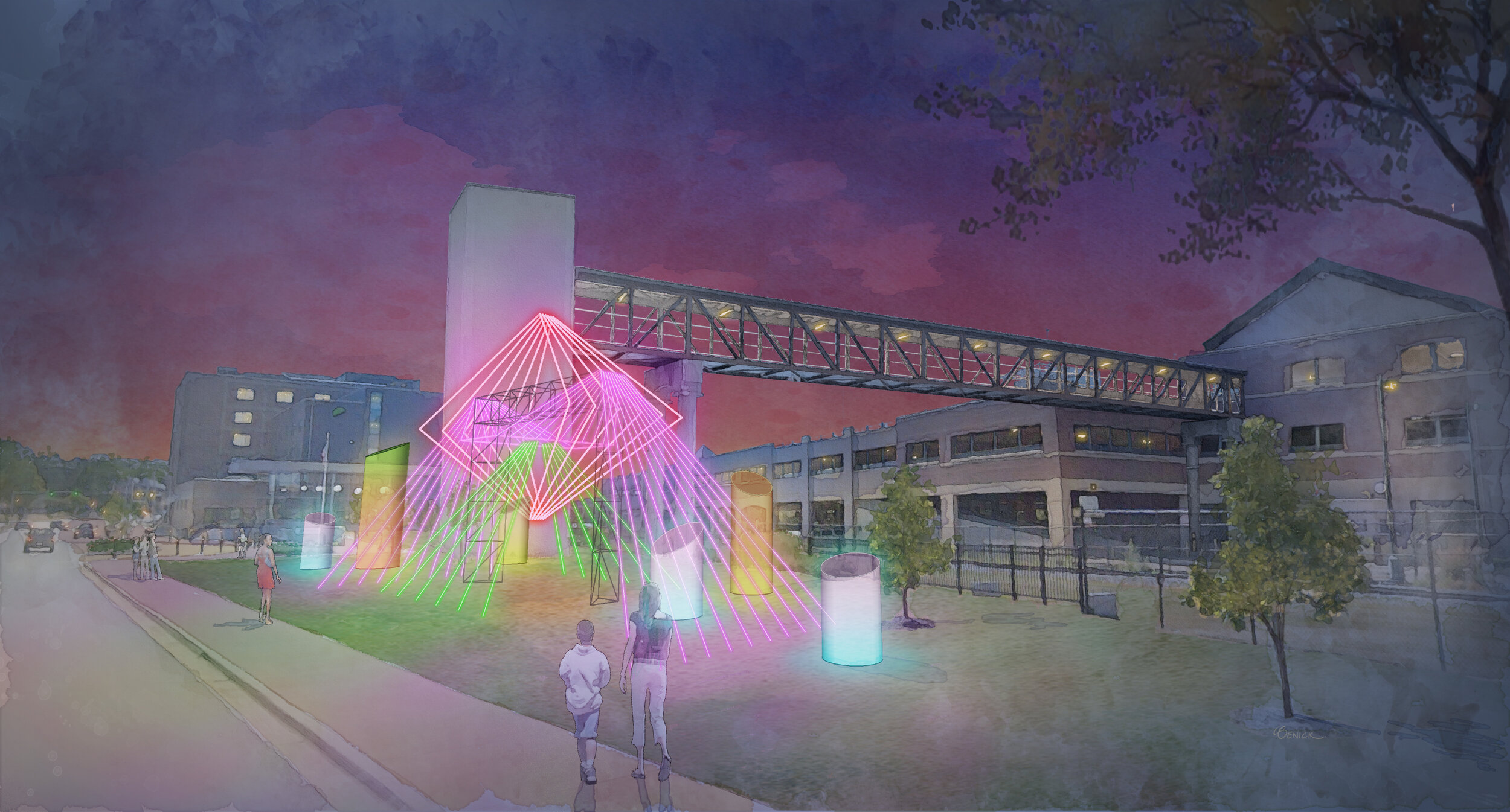
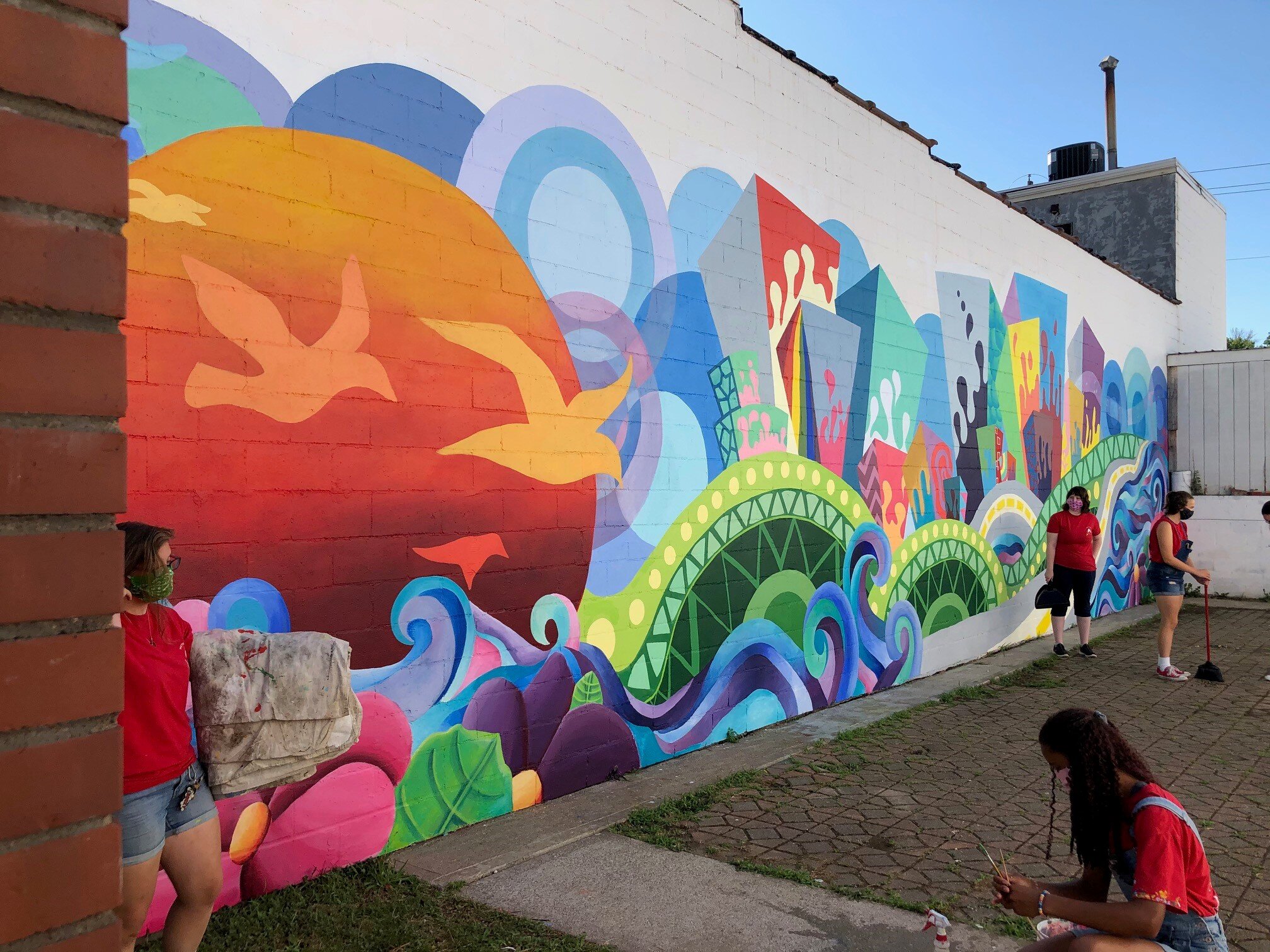
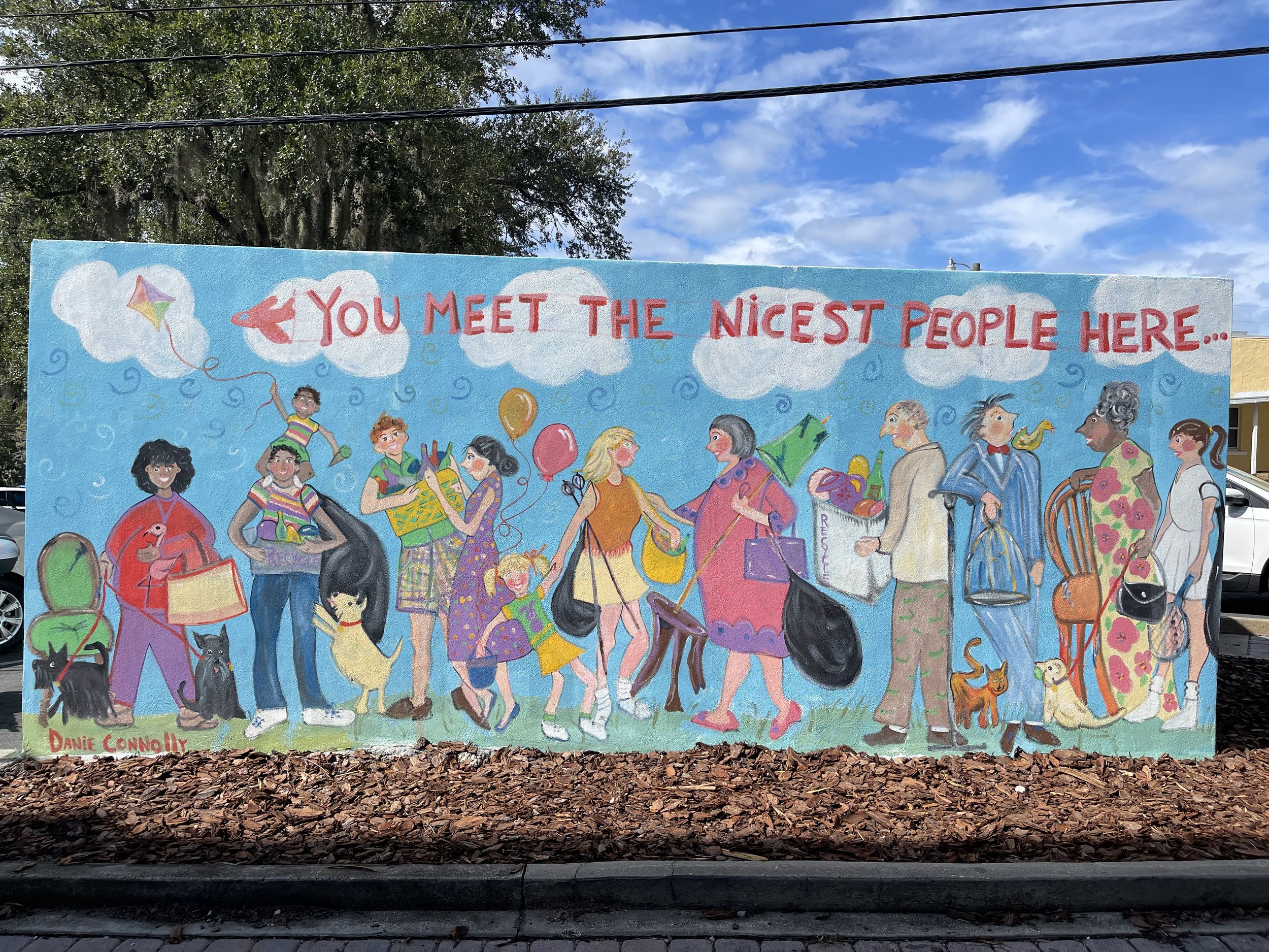
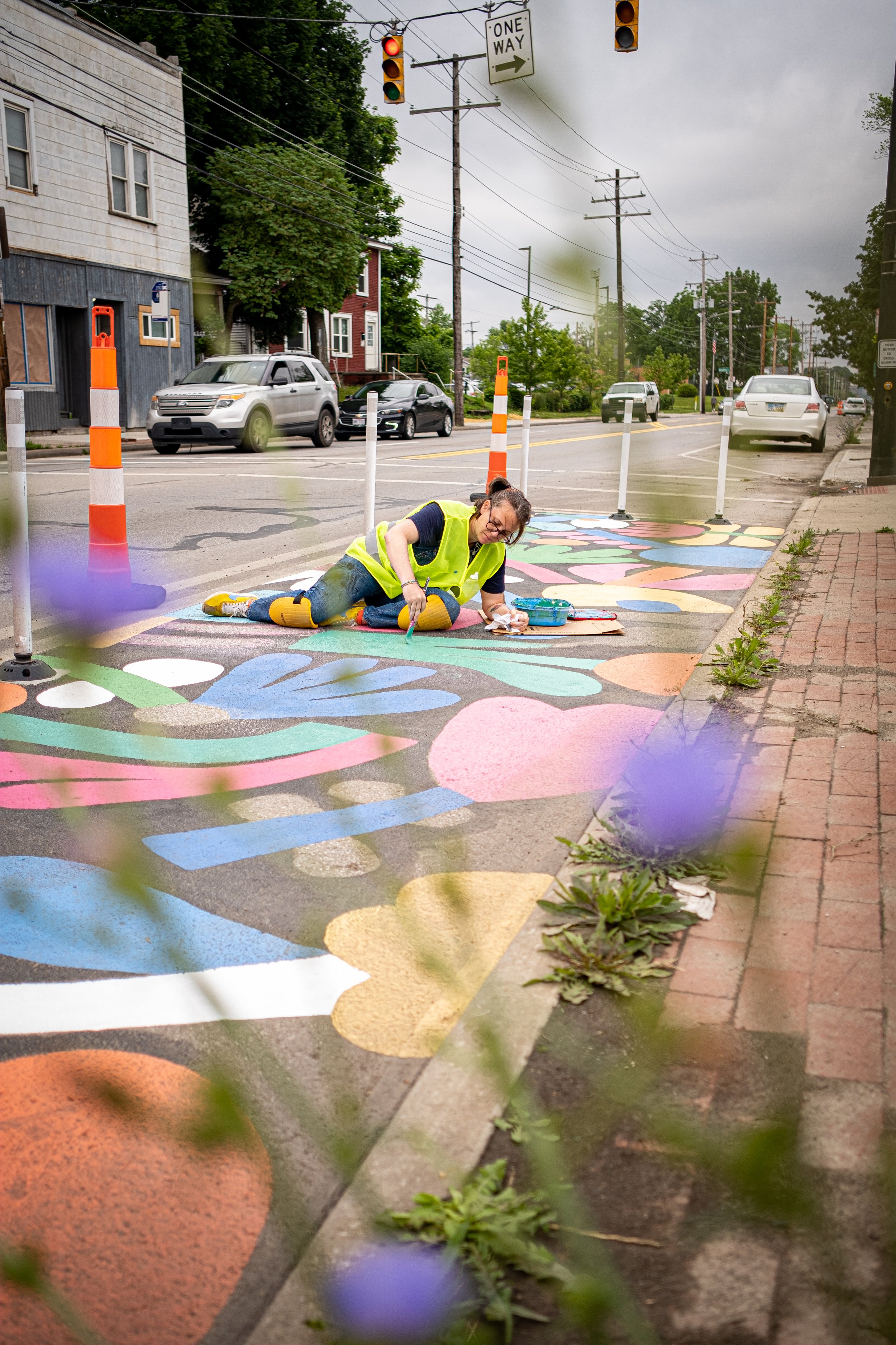
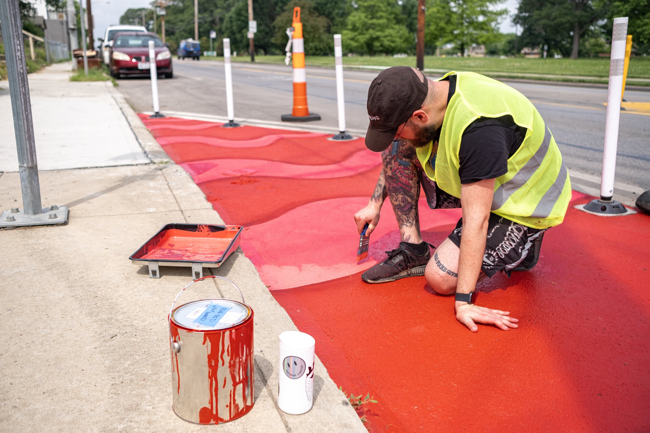
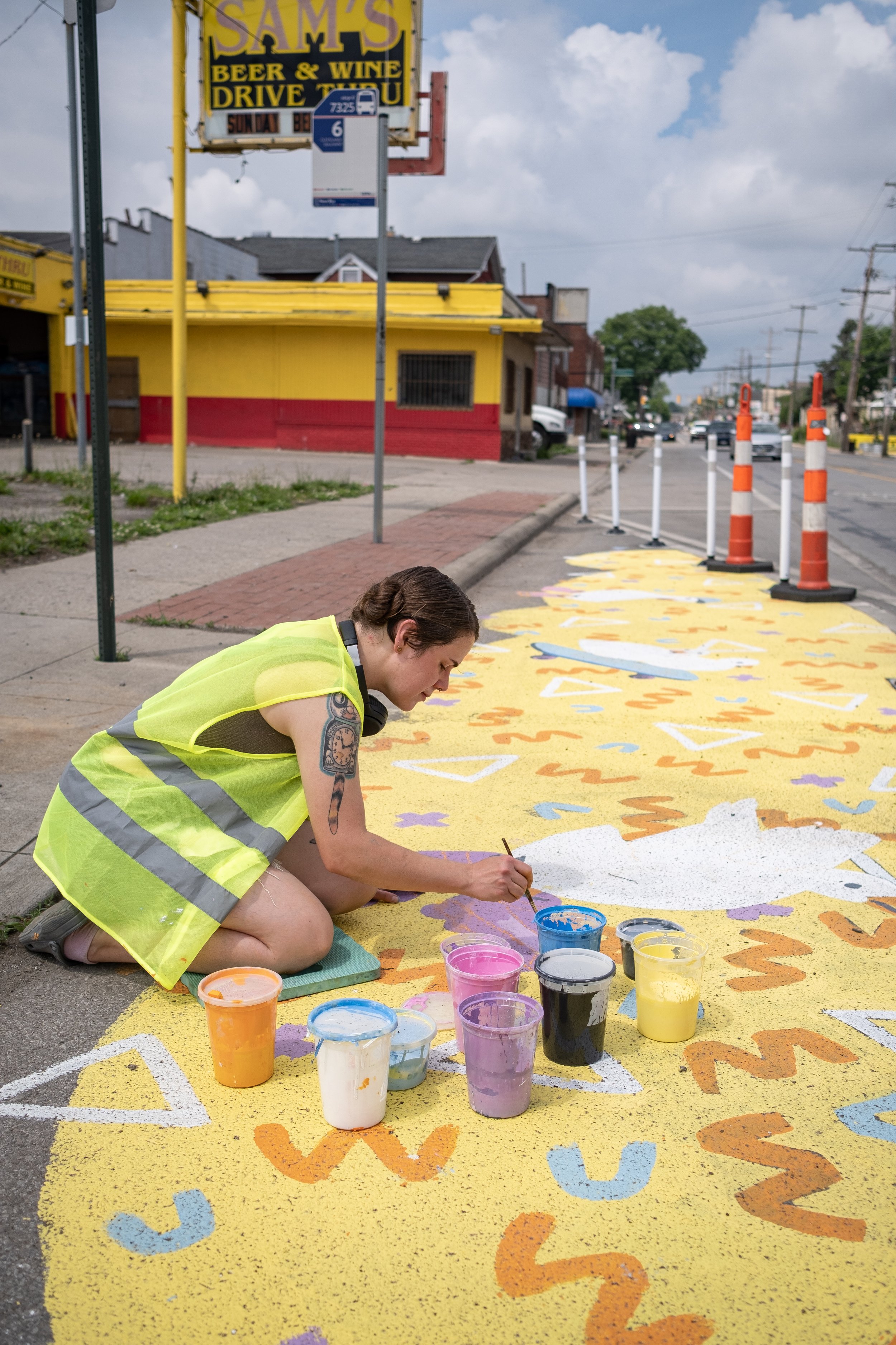
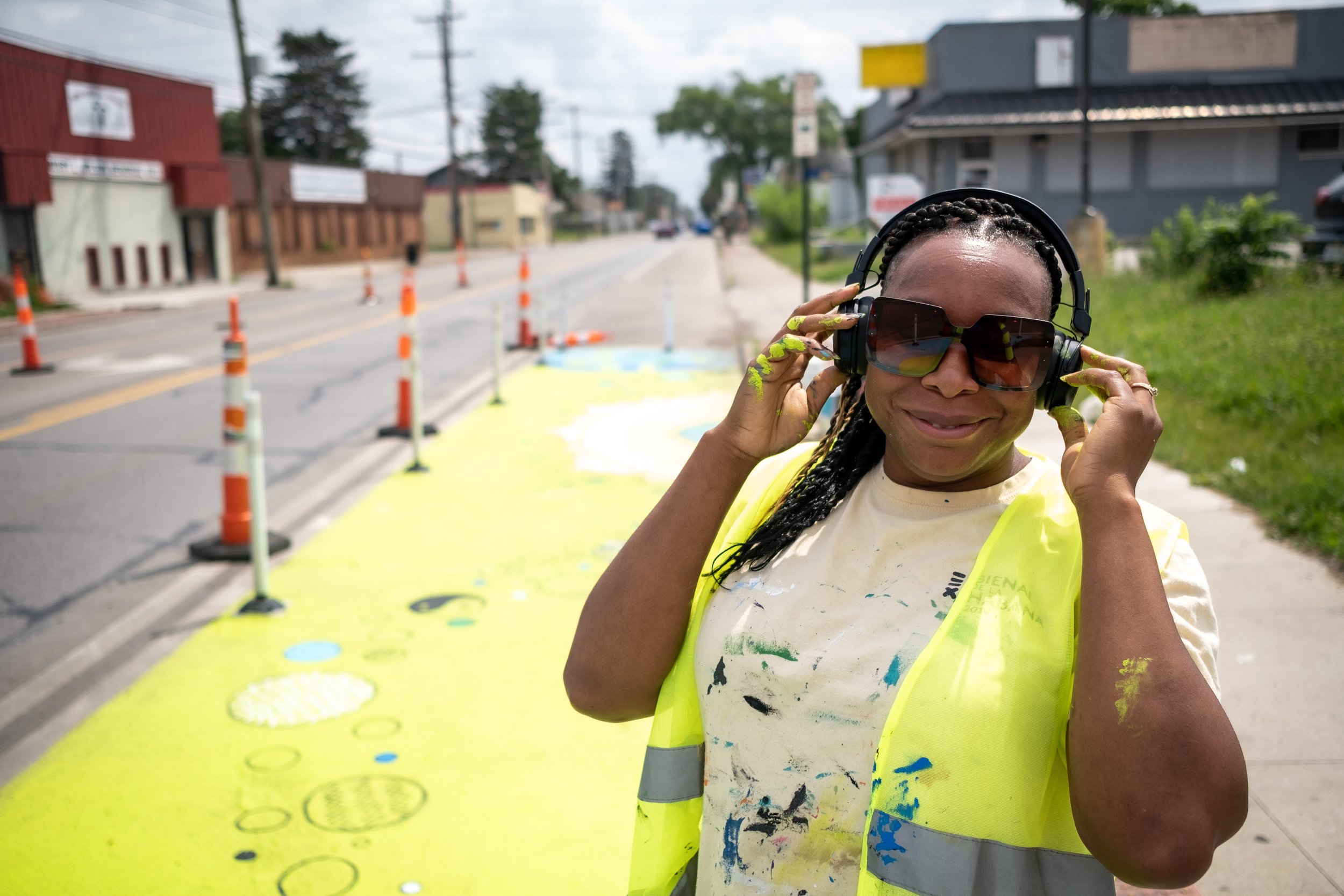
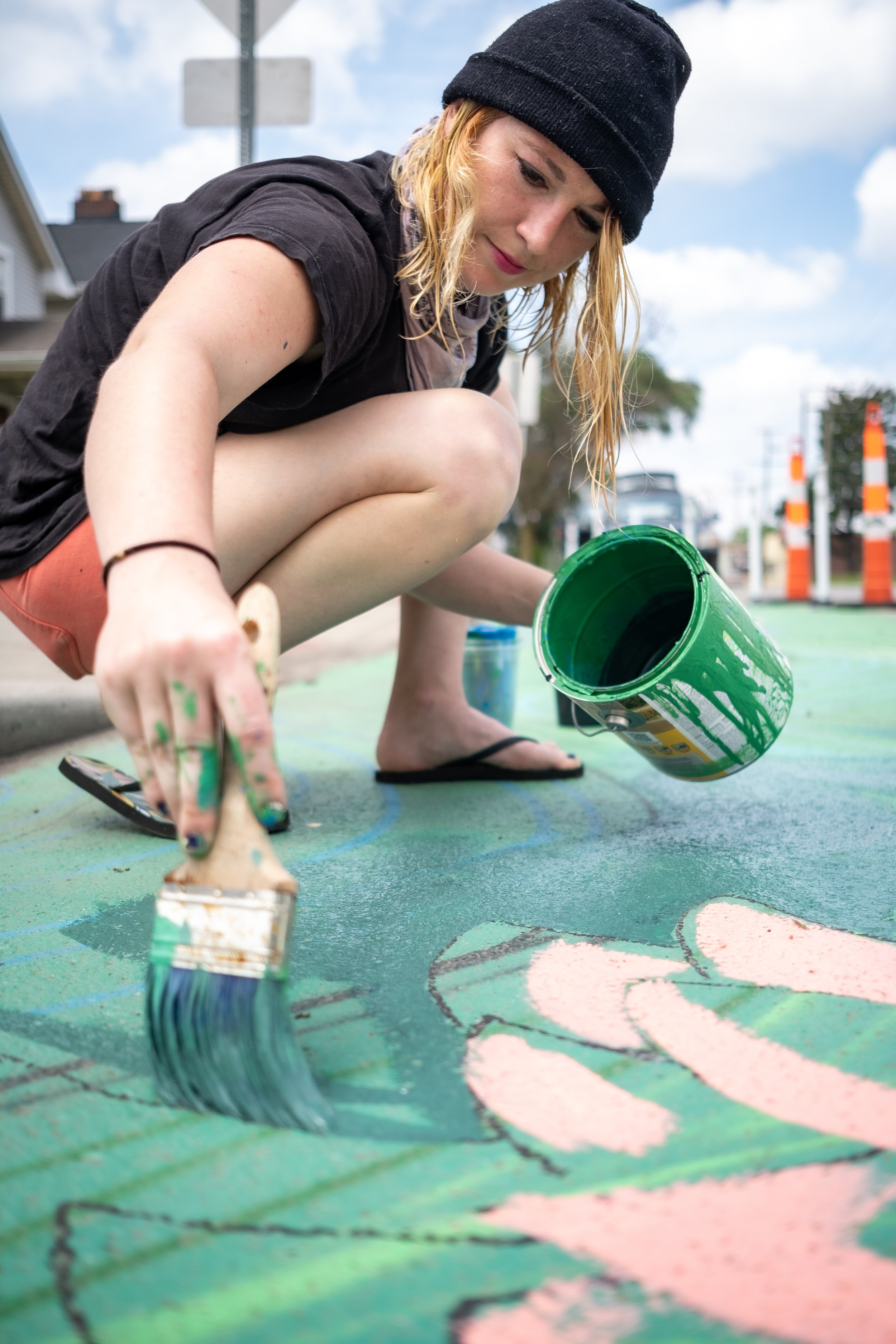
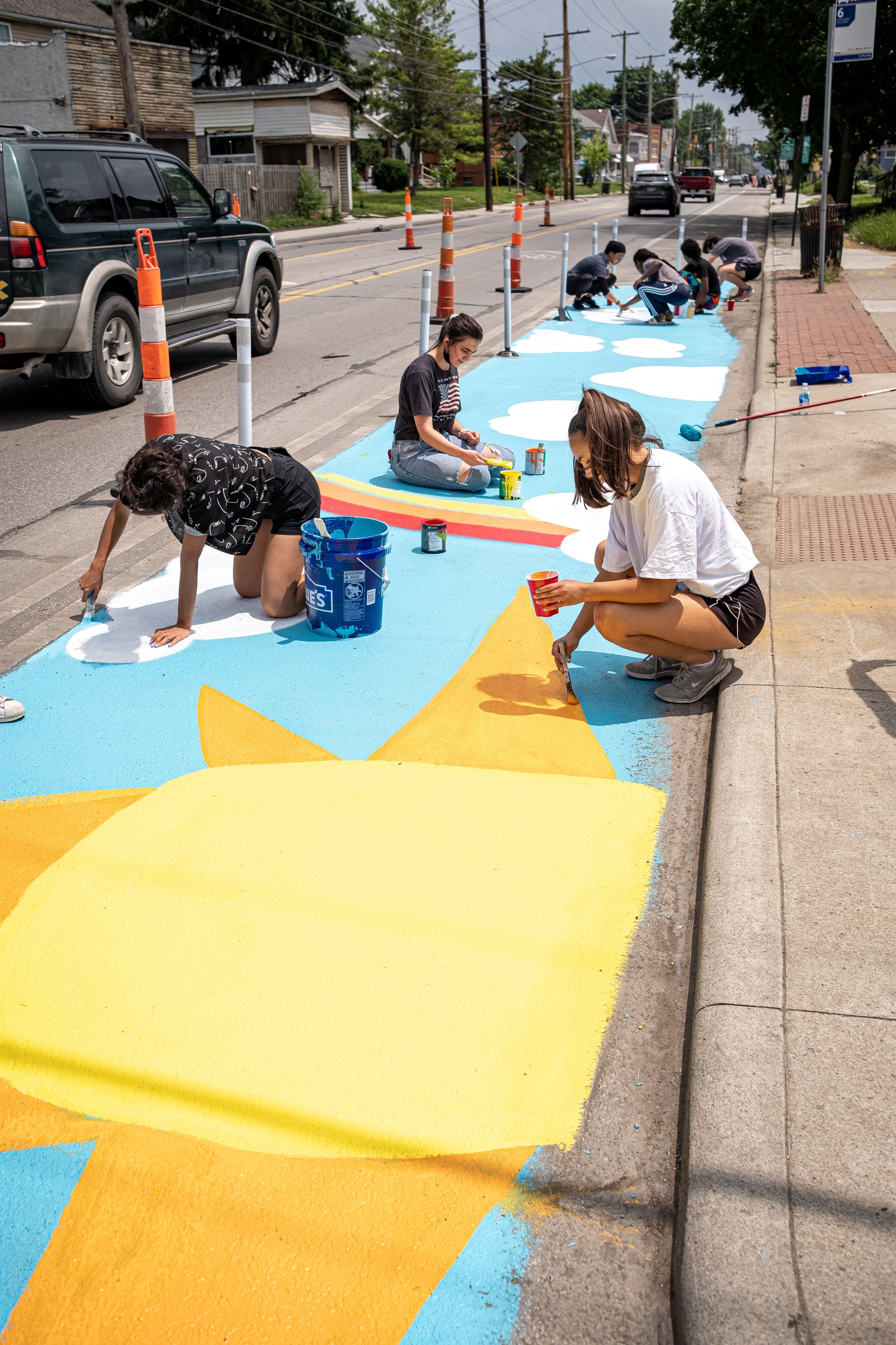
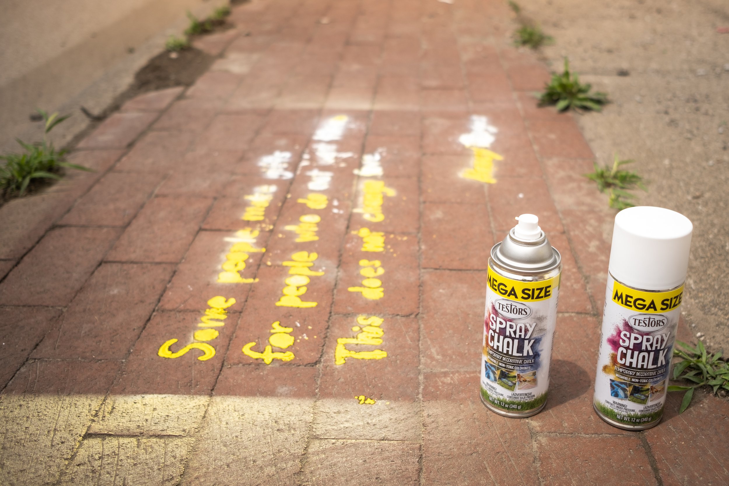
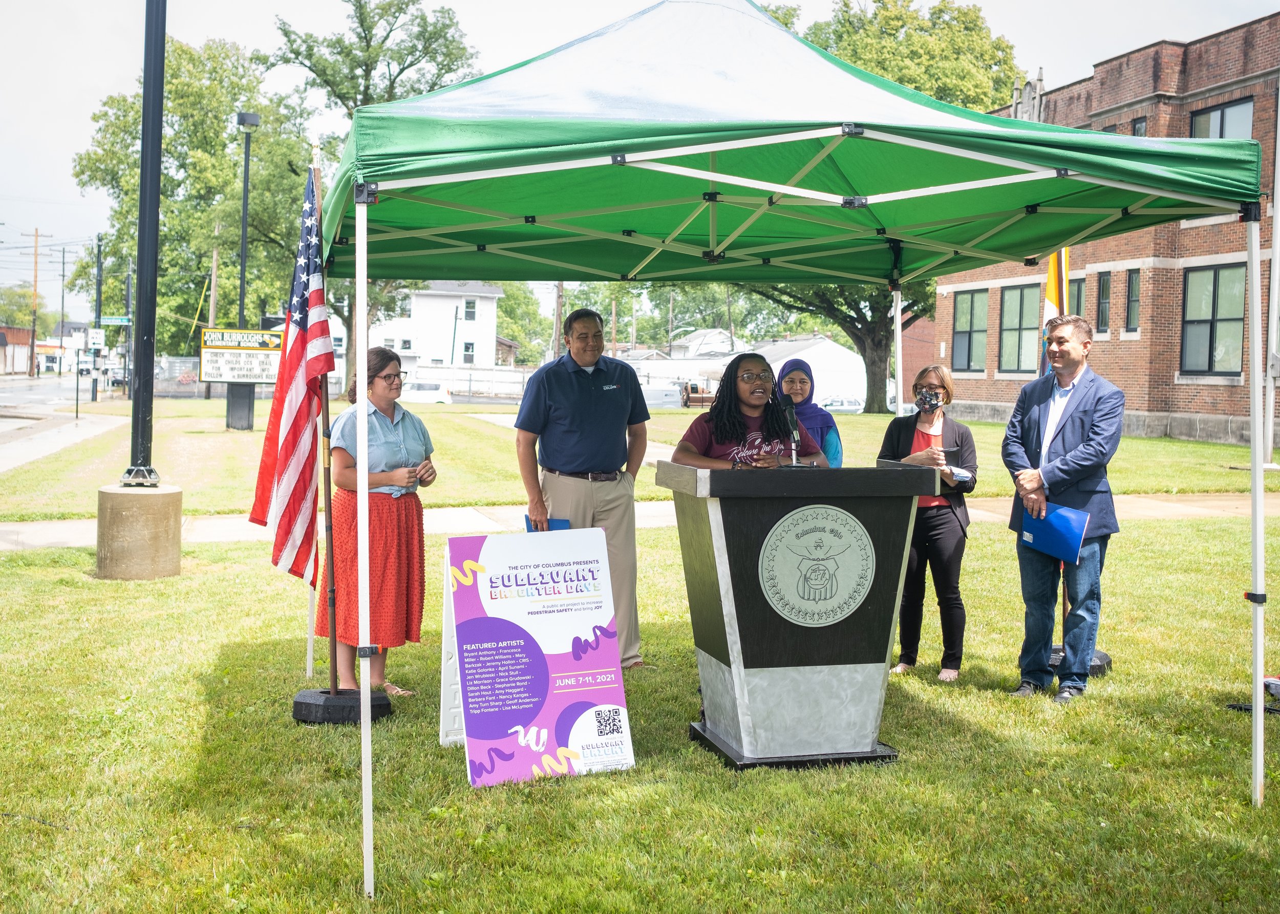
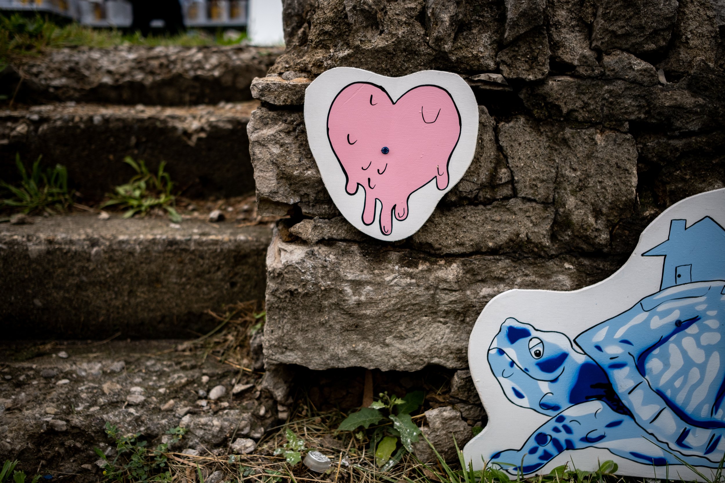
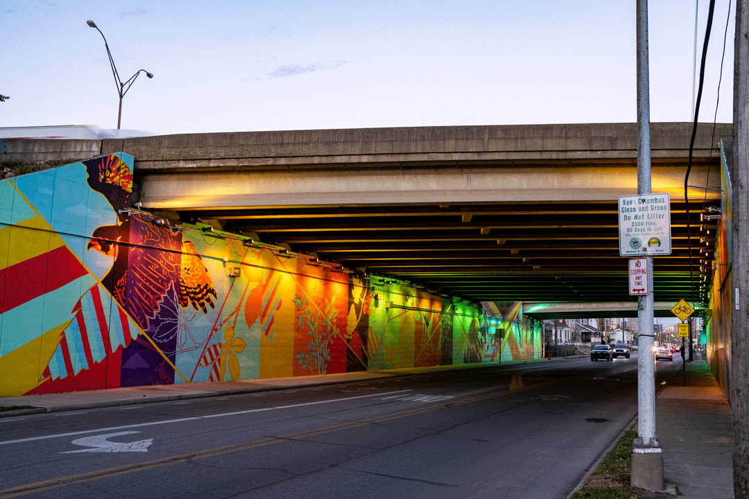
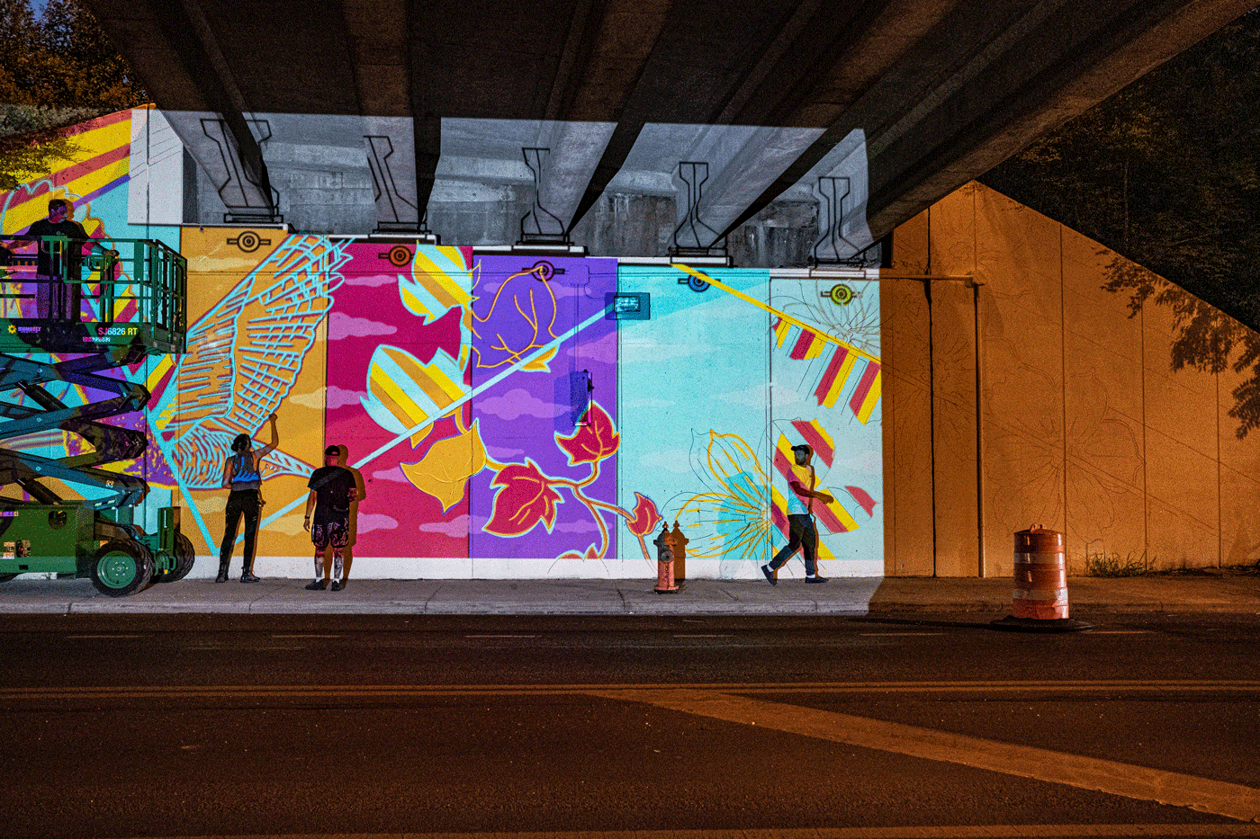
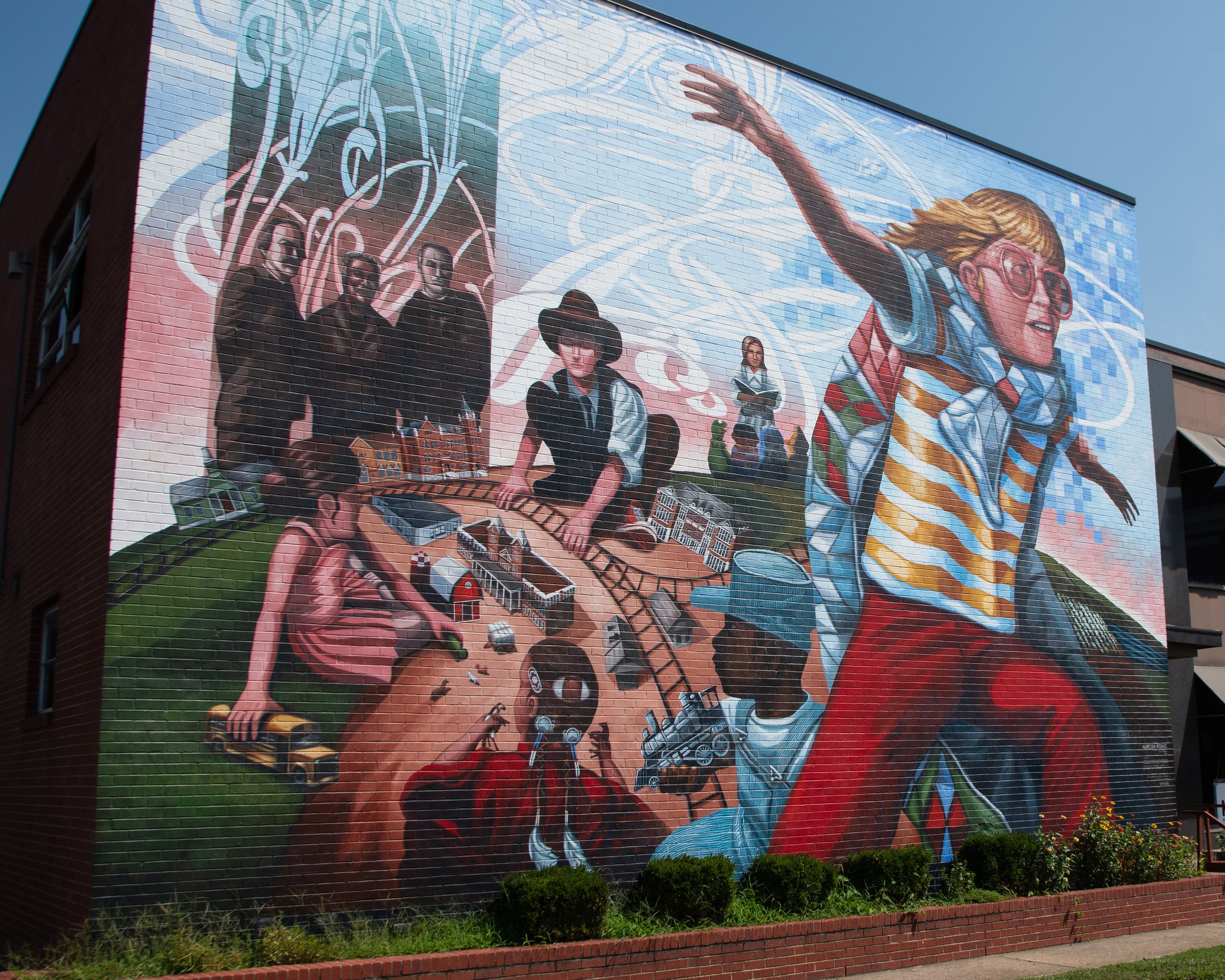
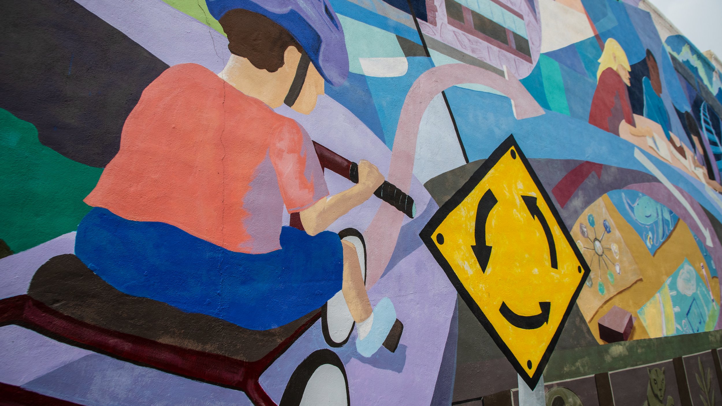
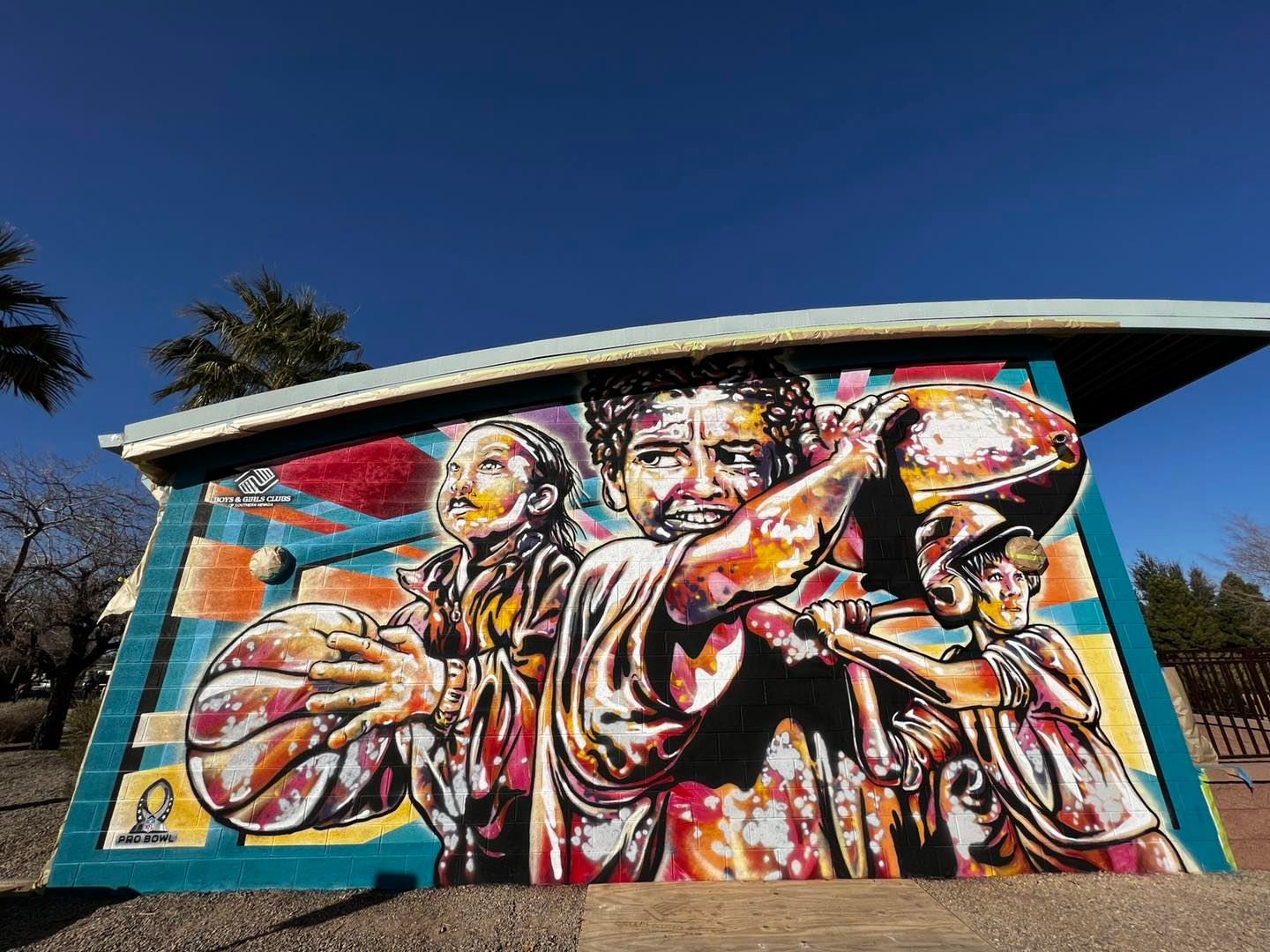
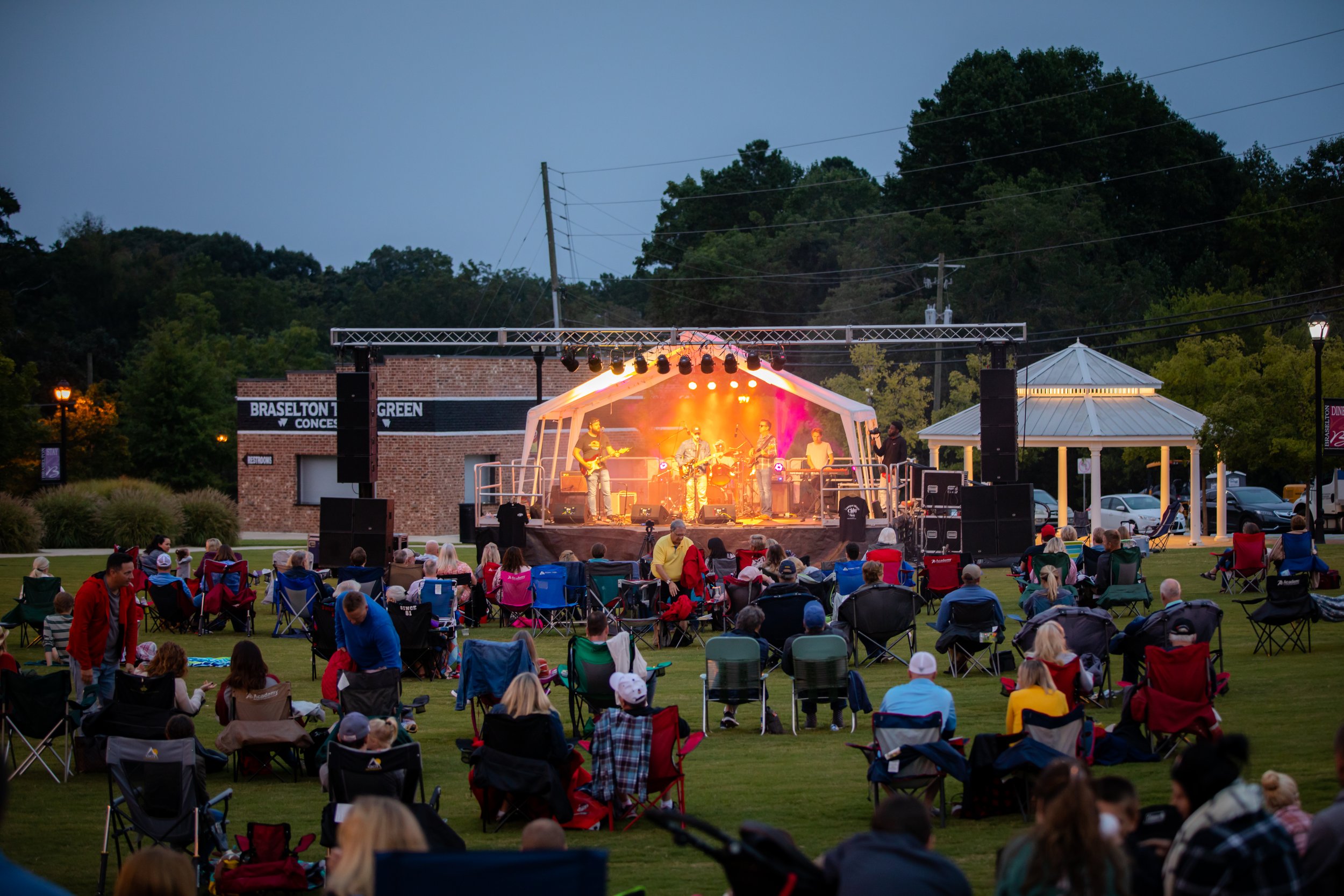
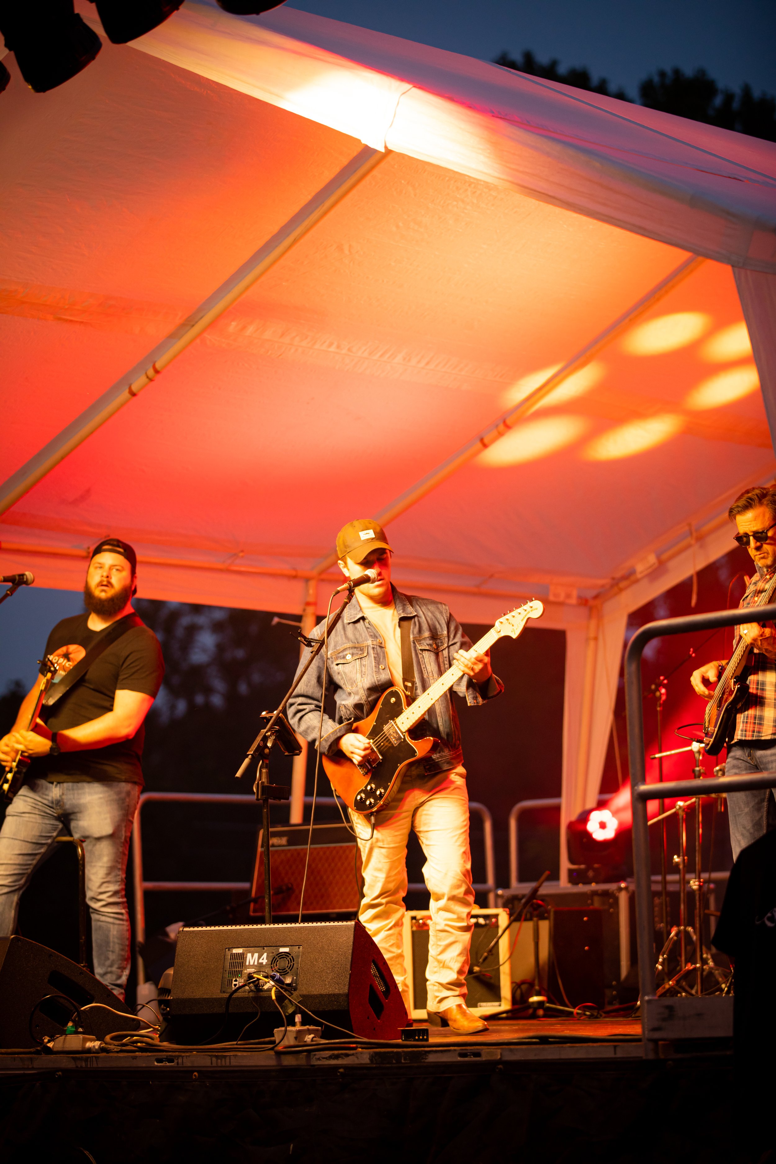
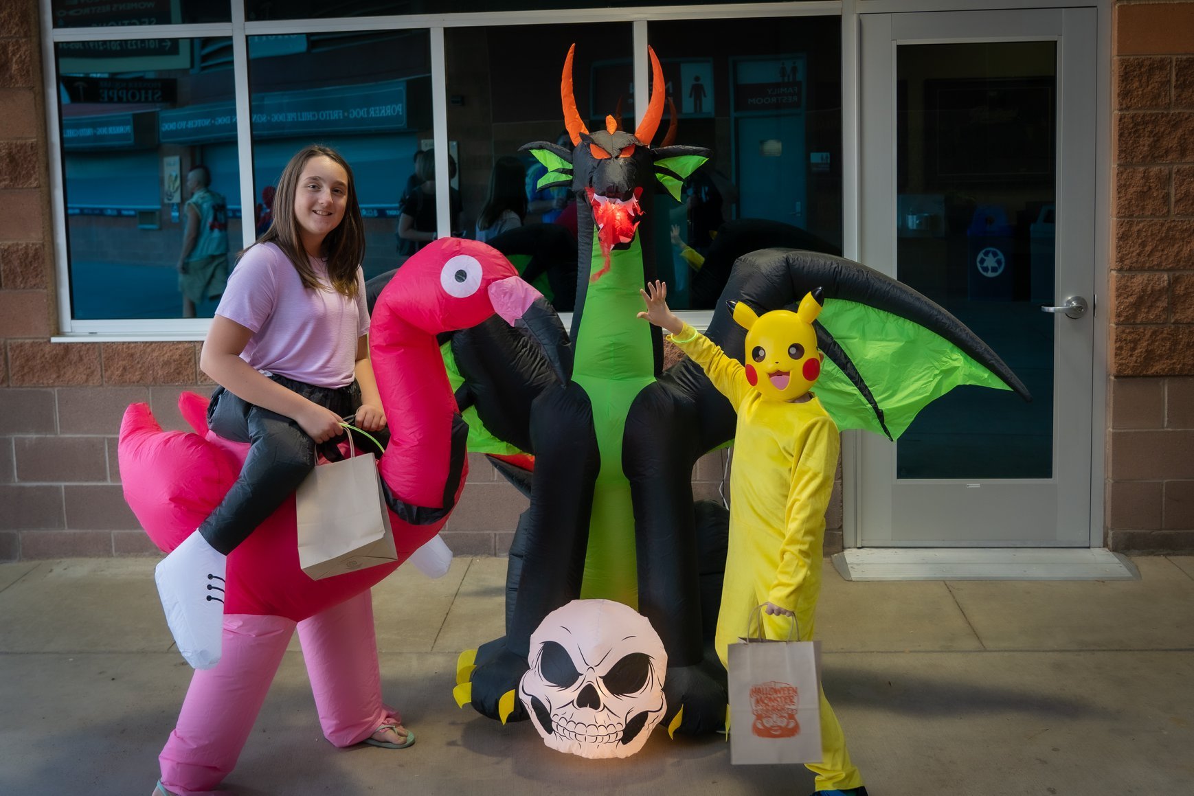
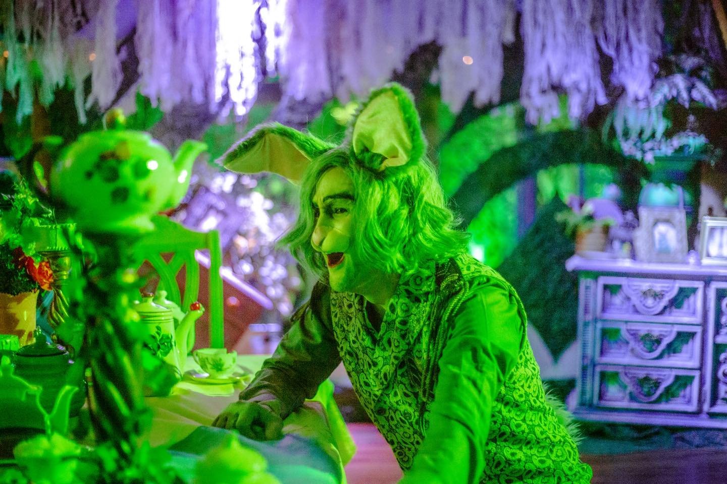
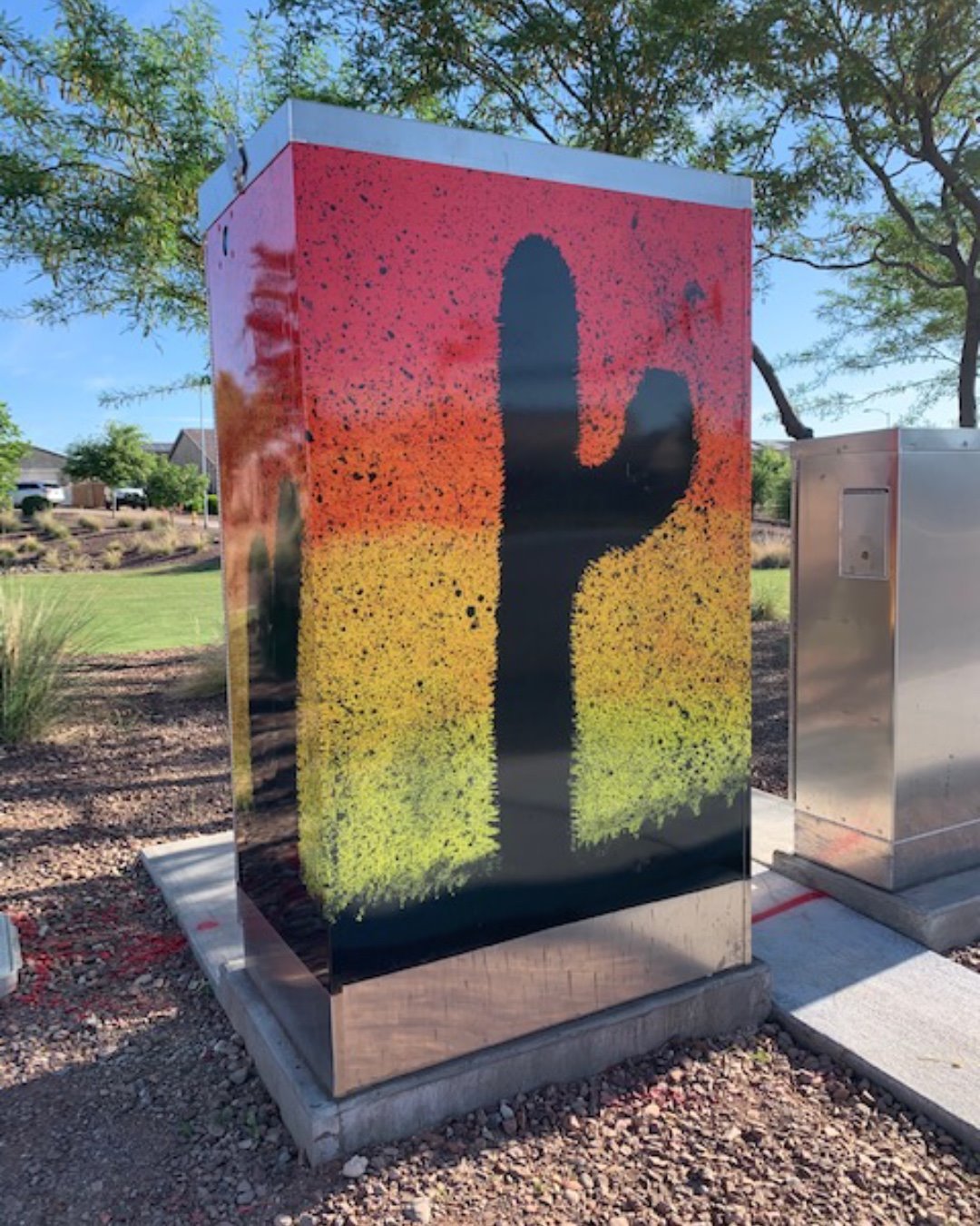
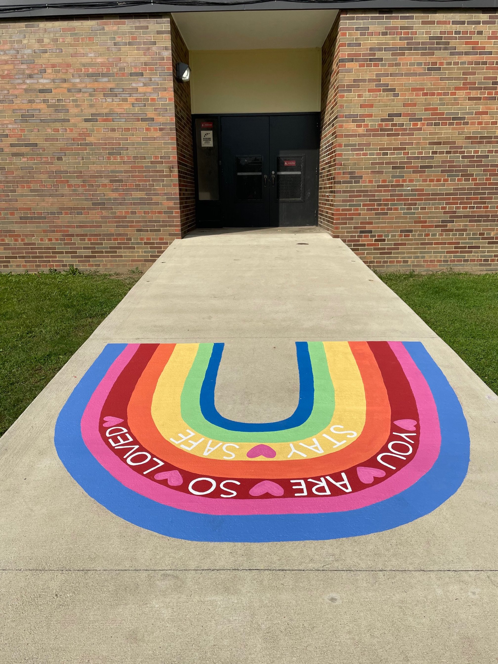
Sullivant Bright Public Art & Parklet Project
Columbus, Ohio
WHY
Sullivant Avenue is a place of authentic creativity, featuring a prominent mural and numerous custom signs. The Sullivant Bright Public Art Project is part of a larger $10 million rehabilitation project (2% of which is devoted to public art) that began in May 2020. It used public art to elevate the corridor and creatively showcase where future infrastructure improvements would be installed.
HOW
As project engineers evaluated a 1.9-mile corridor along Sullivant Avenue for necessary pedestrian upgrades, Designing Local considered public art and placemaking opportunities along the corridor, particularly where public art or a placemaking intervention could support a safer pedestrian environment. Twenty-one artists were tapped to create temporary public art installations that wowed the neighborhood with their bold, colorful designs.
WHAT
This project demonstrates the firm’s abilities to provide strategic direction for placemaking and land use issues as well as the firm’s capabilities to both develop and communicate creative concepts which contribute to community safety and sense of place.
Sidewalk bump-outs and pedestrian refuge islands were constructed to shorten the distance to cross the street, make pedestrians more visible, and help to slow driver speeds. Data collected after implementation shows that crashes decreased by approximately 50%, and extreme speeding (50+ mph) was reduced by as much as 92%.
SULLIVANT BRIGHT ARTISTS
April Sunami, Bryant Anthony, Dillon Beck, Francesca Miller, Grace Grudowski, Jen Wrubles, Jeremy Hollan with CRIS artists, Katie Golonka, Mark Barkzak, Nick Stull, Liz Morrison, Robert Williams, Stephanie Rond, Amy Haggard, Sarah Hout, Barbara Fant, Nancy Kangas, Amy Turn Sharp, Geoff Anderson, Tripp Fontane, Lisa Mclymont. Photography by Abby Kamagate. Video Production by Aaron Blevins.

Conway Public Art Master Plan
Conway, Arkansas
WHY
Conway is a city in Central Arkansas known for its family-friendly vibe, youthful outlook, and vibrancy. The so-called ‘City of Colleges’ has crafted its own unique identity with beautiful college campuses, peaceful nature trails, access to gorgeous lakes, an impressive river, and plenty of restaurants and cool local spots. But Conway’s passionate community members sought to further improve their quality of life by defining the role of public art in their city. They asked, “How can we grow our identity as a city known for supporting creativity? How can we invest now so that we are known as a hub for the arts in the future?” These questions led to the creation of their first Public Art Plan.
HOW
Significant community engagement helped define who Conway is and wants to be known as throughout Central Arkansas and the state. Strategy was a major focus of planning, as a high degree of impact was desired from the start of the new public art program.
WHAT
Conway’s Public Art Plan lays the foundation for the future of public art in Conway and prepares the city to begin injecting artwork into all facets of its community.

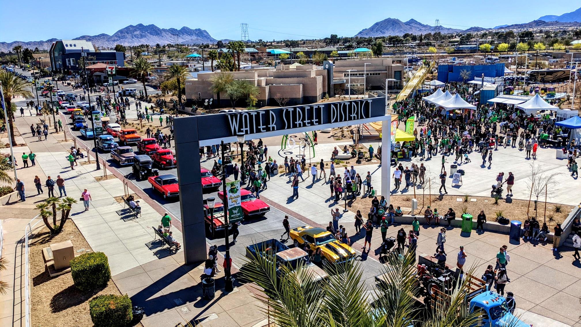
Arts Launch Henderson
Henderson, Nevada

WHY
Henderson is a city with a longstanding upward trajectory and now is a unique moment to continue that forward movement with a large-scale focus on arts and culture. Over the previous decades the City of Henderson along with its partners have undertaken numerous arts and culture efforts. This plan builds off these previous informal efforts and seeks to formalize an arts and culture program in order to take the city to the next level of success in the arts.
HOW
The plan provides a blueprint by which Henderson can stake its claim as the foremost community for arts and culture in Southern Nevada. We begin by establishing a vision for arts and culture in Henderson and detailing the projects, programs, facilities, and partnerships that can be capitalized upon to advance strategic objectives. We then go in depth into the details of how to operationalize and fund ambitious new initiatives through a formal Arts & Culture Henderson program — as well as how this program would function. Finally, we dream big to explore potential projects that could launch Henderson with a detailed action plan.
WHAT
In addition to public engagement this plan is built upon intention. From the beginning the planning team and city staff determined that this plan should not only be visionary but should also be highly actionable. The plan would also need to be highly policy driven and one of the first outcomes of the planning process was the development of the Henderson Public Art Policy. The plan is also built upon the city’s other planning efforts. Throughout the document you will see efforts derived from the Strategic Plan, the Parks and Recreation Master Plan and other planning efforts the city has undertaken.

Downtown Caldwell Revitalization Plan
Caldwell, Ohio
WHY
Downtown Caldwell was recently listed on the National Register of Historic Places, and is now working toward a renaissance. With numerous local businesses and an assortment of beautiful historic buildings, Caldwell is ready to be a thriving center for both local residents and tourists. This plan builds upon the village’s momentum to create a number of recommendations for community branding, historic preservation development, placemaking, wayfinding, access to recreational facilities, and other improvements.
HOW
Designing Local first worked with village leadership to develop a brand identity for Caldwell. We then made a number of recommendations for relatively low-cost, high-impact placemaking opportunities, including a courthouse square light canopy, unique signage, historically appropriate site furnishings, and locations for public art. Working with our project architect, Designing Local also created a historic preservation recommendations for one of the most visible buildings in downtown, which included a strategy for attaining a Historic Tax Credit to make the project financially viable.
WHAT
The project plan was completed in Spring 2022. The new brand identity was immediately implemented, and the various project recommendations will be submitted as appropriate for federal stimulus and infrastructure funds.


Braselton Public Art Master Plan
Braselton, Georgia

WHY
When Braselton leaders determined that the city’s future would center public art, they set out to create a Public Art Master Plan that outlined a new Public Art Program.
HOW
Through many conversations with city leaders and members of the public, Braselton coalesced around a vision for public art in their city that would honor its history and special qualities, create a strong sense of place, enhance community assets, and support a high quality of life for all residents.
WHAT
The Braselton Public Art Master Plan was approved in January 2022, at which time applications were being accepted for the new Braselton Arts Council.

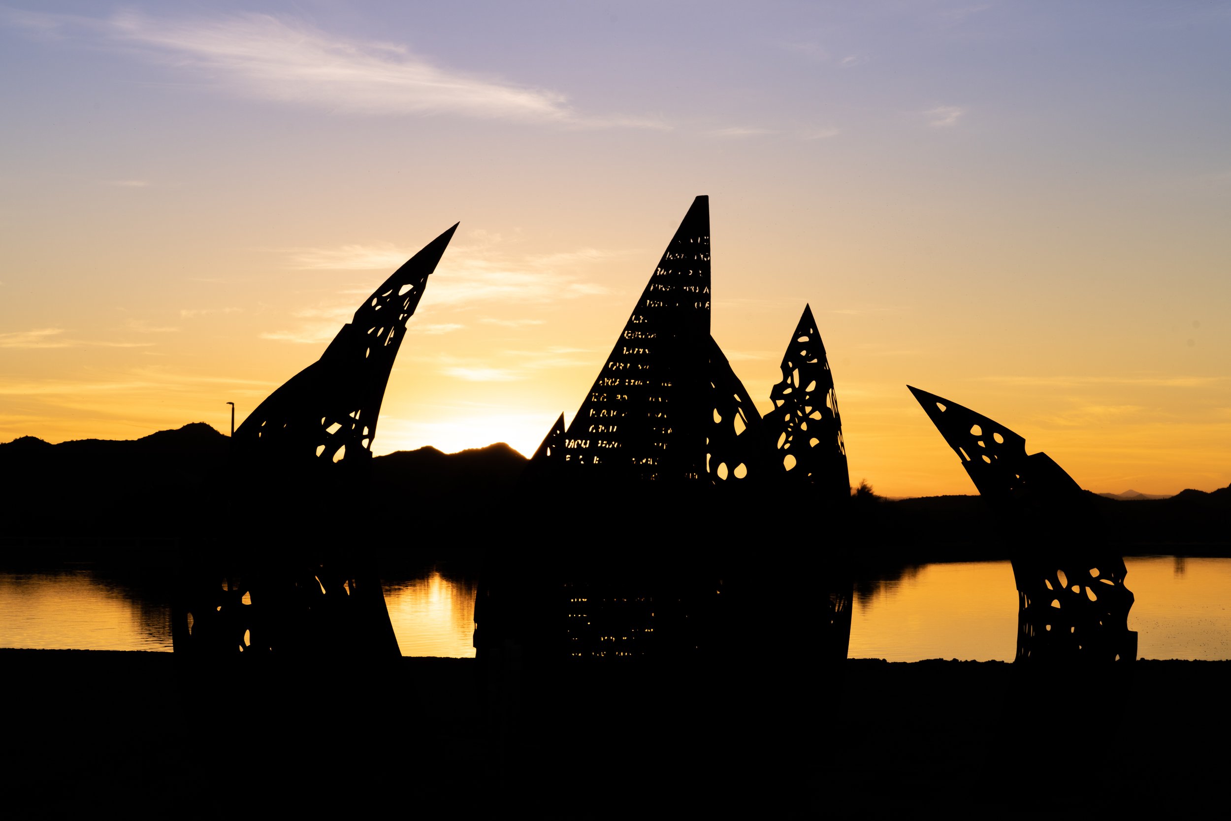
Peoria Arts & Culture Plan
Peoria, Arizona

WHY
Peoria is a well-established but fast growing city West Valley of the Phoenix Metro Region. The city has long focused on providing public art and cultural amenities for its residents and has had many successes since the adoption of the an Arts Master Plan in 2009. With most of the goals from the 2009 plan achieved and new leadership in place there was key opportunity to re-evaluate the program and determine next steps.
WHAT
The Peoria Arts & Culture Plan focuses on six key priorities that are bolstered by strategies and big ideas connected to the priorities to support transformational change. Extensive research and mapping supported the needs residents expressed in surveys and interviews: access to arts and culture needed increase to areas where it is not easily accessible.

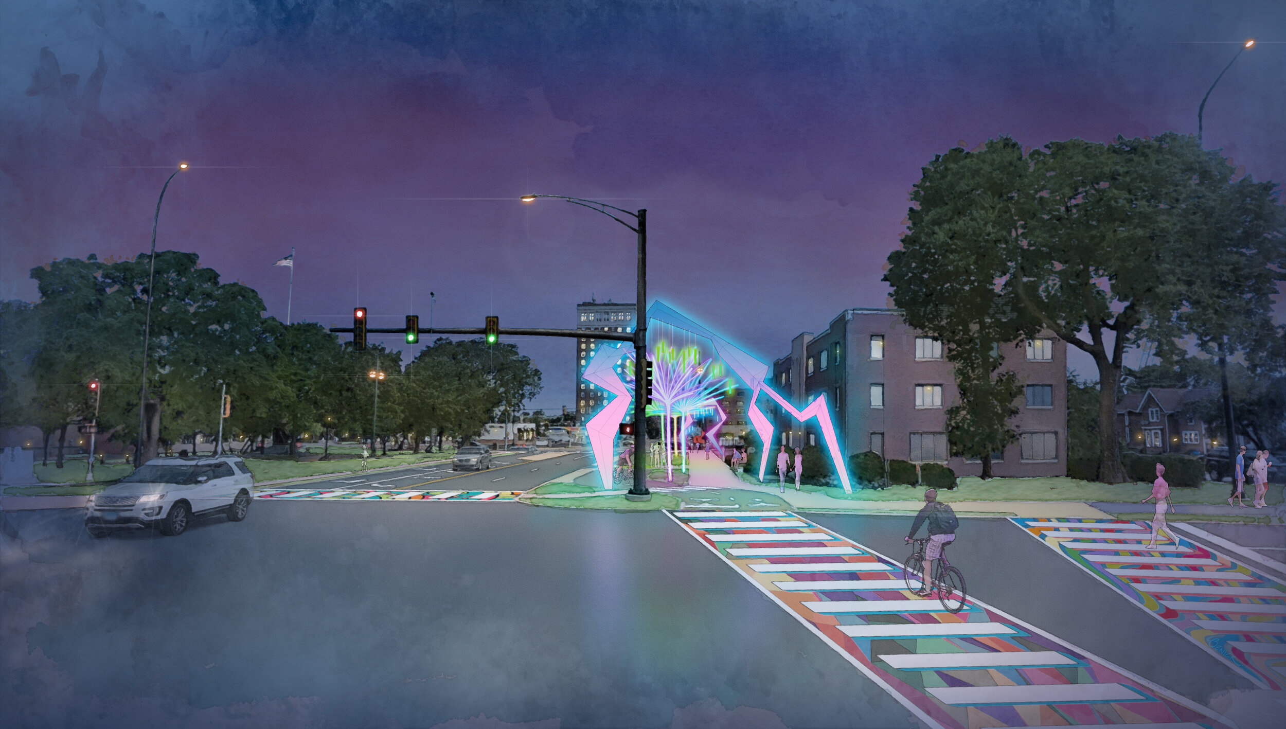
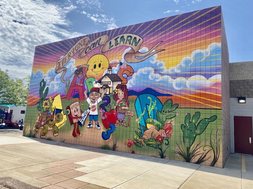
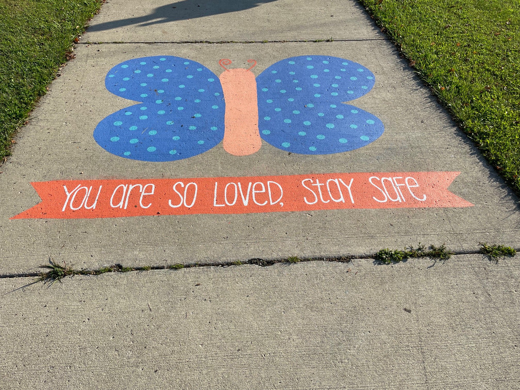
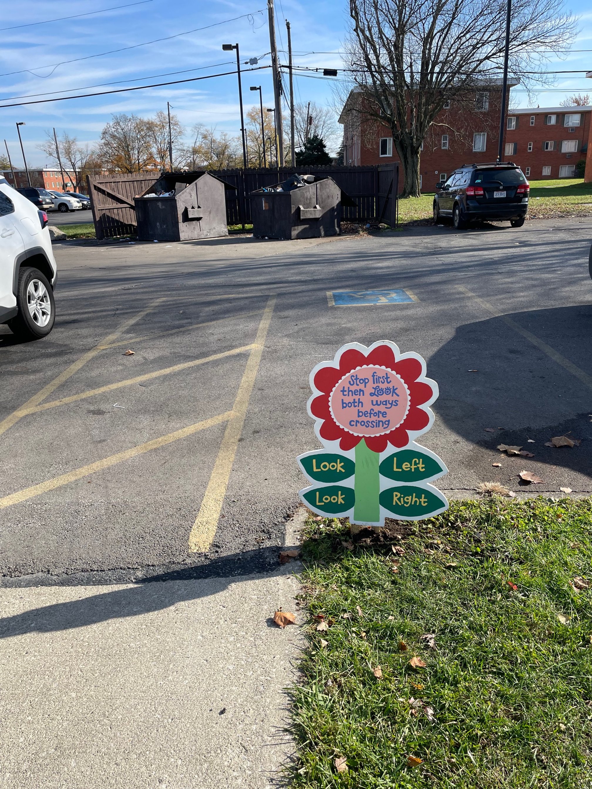
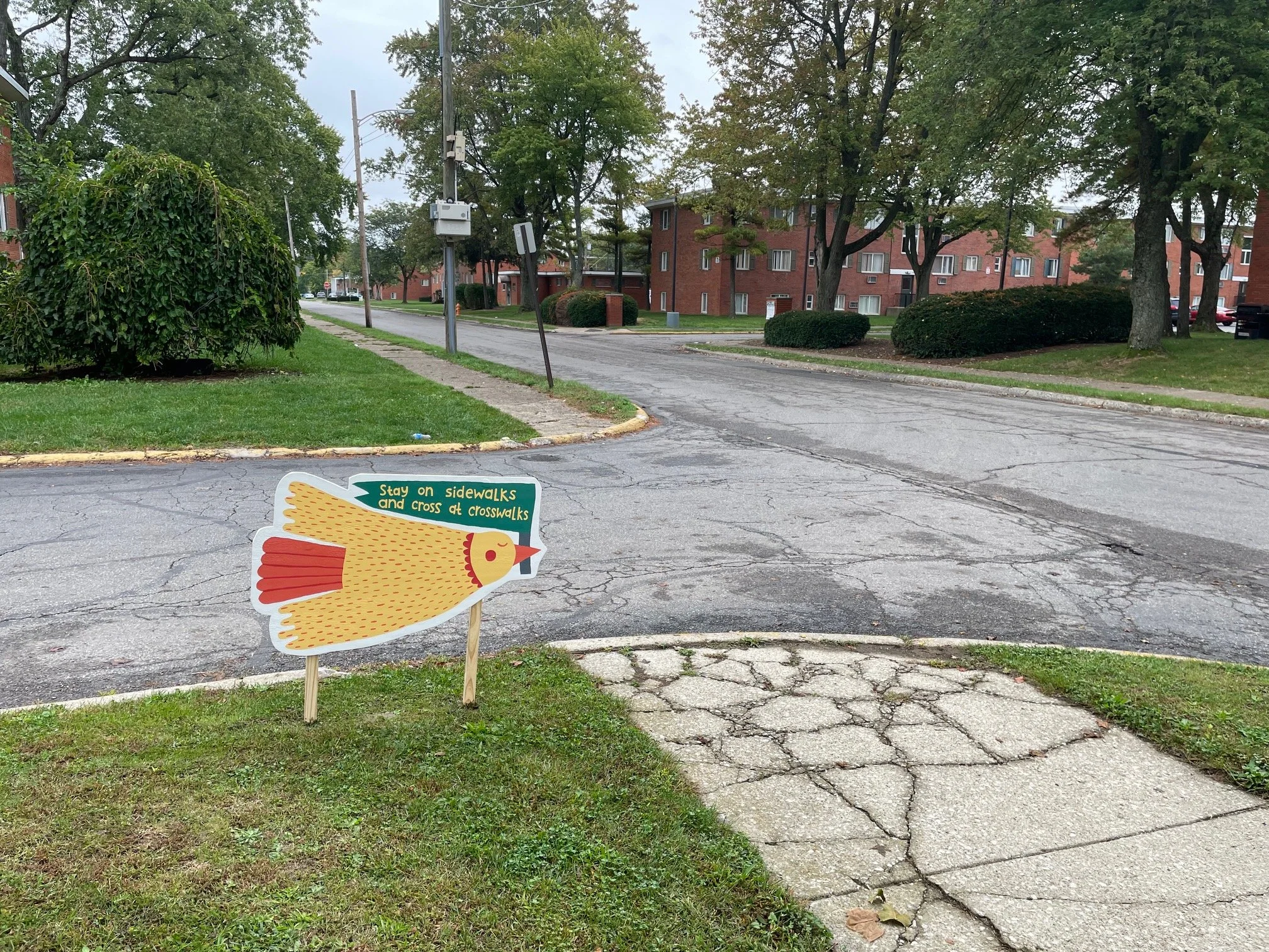
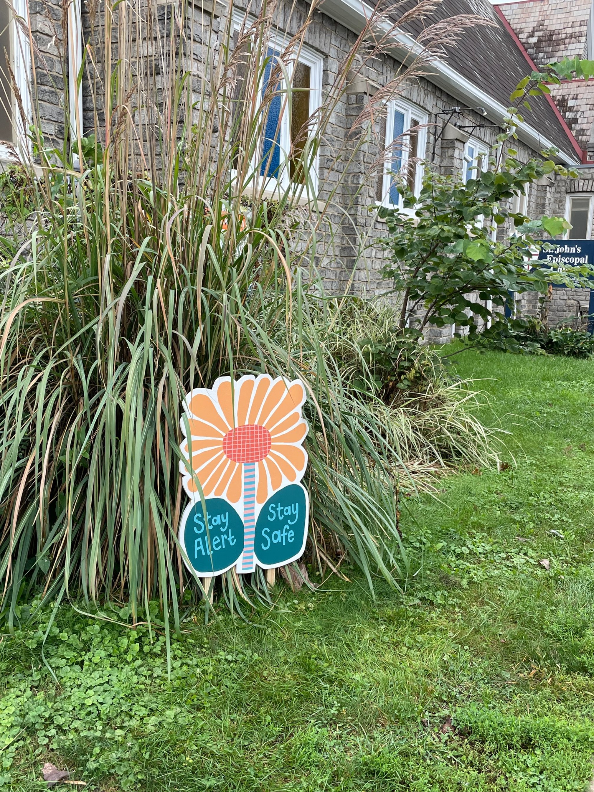
Safe Routes to School Placemaking Project
Columbus, Ohio

WHY
Columbus Public Health received a grant to develop placemaking concepts using public art around two elementary schools on Columbus’ West Side — Avondale Elementary and Eakin Elementary. The placemaking and public art concepts encouraged students to walk and bike safely to school along the designated safe routes established by Columbus Public Health.
HOW
Designing Local worked with artist Amy Haggard, the Artmobile, and Columbus Public Health to plan interventions along the route at the highest-traveled points around each school.
WHAT
Amy Haggard developed fun, engaging, and educational concepts for the interventions around both elementary schools. Students were given coloring sheets and stickers to celebrate the project.

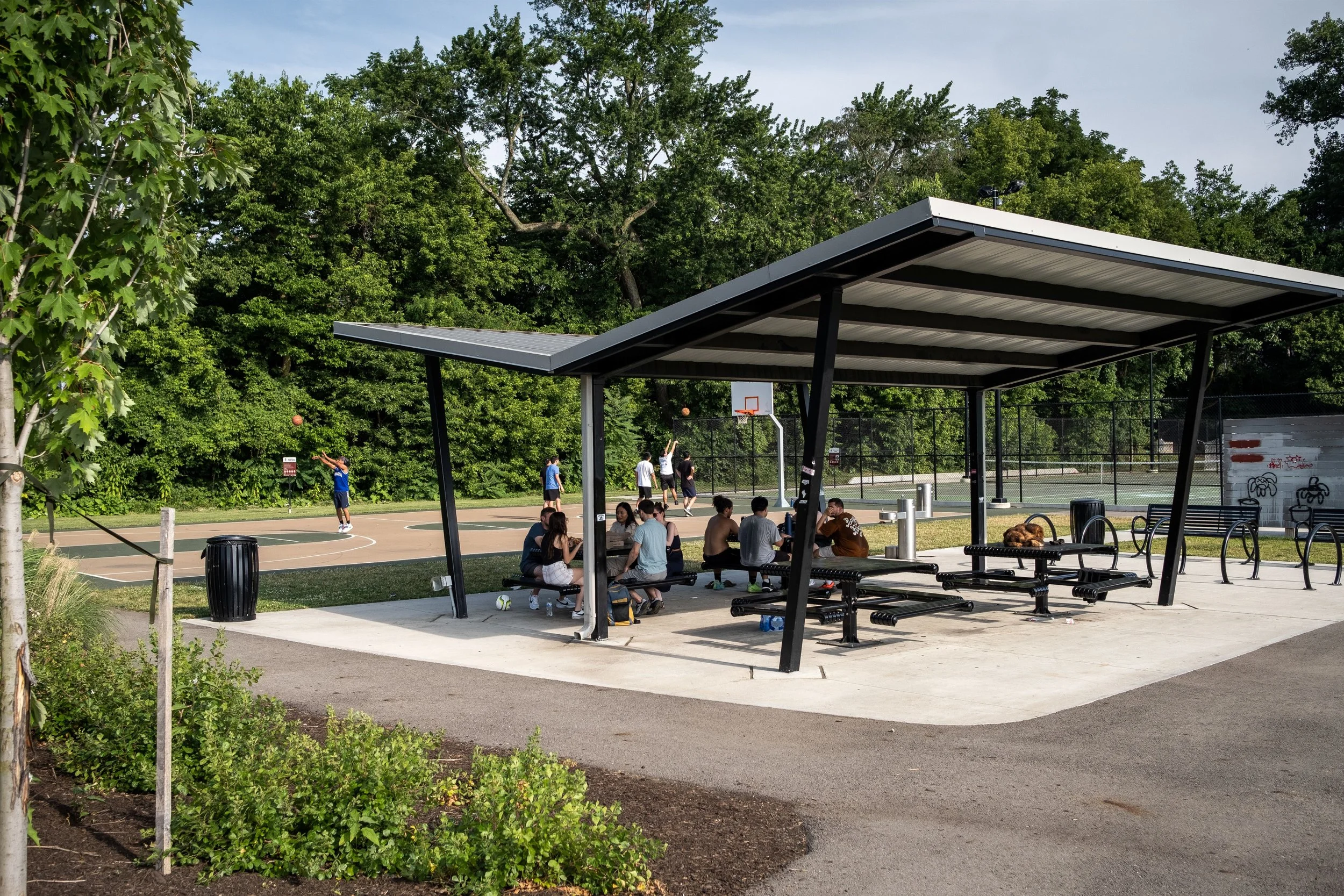
Tuttle Park Lower Field Improvements
Columbus, Ohio

WHY
Tuttle Park is located just to the north of the Ohio State University Campus. The existing park includes several baseball fields, a basketball court, and a shelter that are underutilized and deteriorating. The City of Columbus desires to renovate the park to include uses which will be more effectively utilized by neighborhood residents. New uses will include a skatepark, shelter, event lawn, and dedicated cricket field. The goal is to encourage a sense of ownership through the addition of amenities which are more fitting of area demographics. Additionally, the park includes several historic and public art elements and the City desires to utilize these elements as inspiration for a signage and wayfinding system.
HOW
Designing Local is leading this project with a group of sub-consultants that includes environmental graphic designers, civil, structural and electrical engineers, and a skatepark designer. Designing Local facilitated several public workshops and the results has informed the final design program and various design elements of the park. The skatepark portion of the project scope includes a strategy to deliver the project through a design/build bidding mechanism.
WHAT
Technical design for the project is complete and the project is now in the construction stage. The park opened in fall 2021.
RECOGNITION
2024 ASLA Honor Award, Design-Constructed


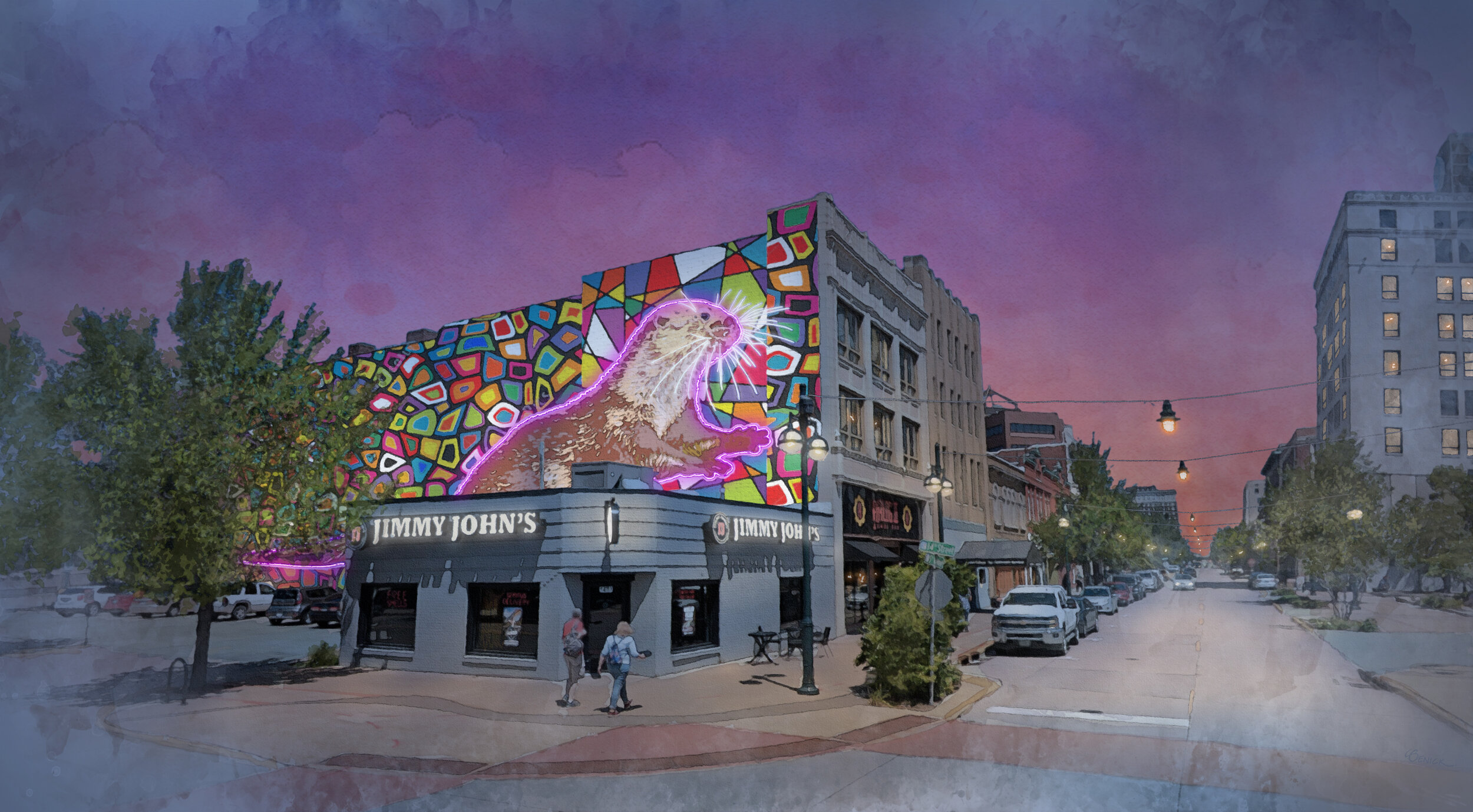
Moline Public Art & Placemaking Plan
Moline, Illinois
WHY
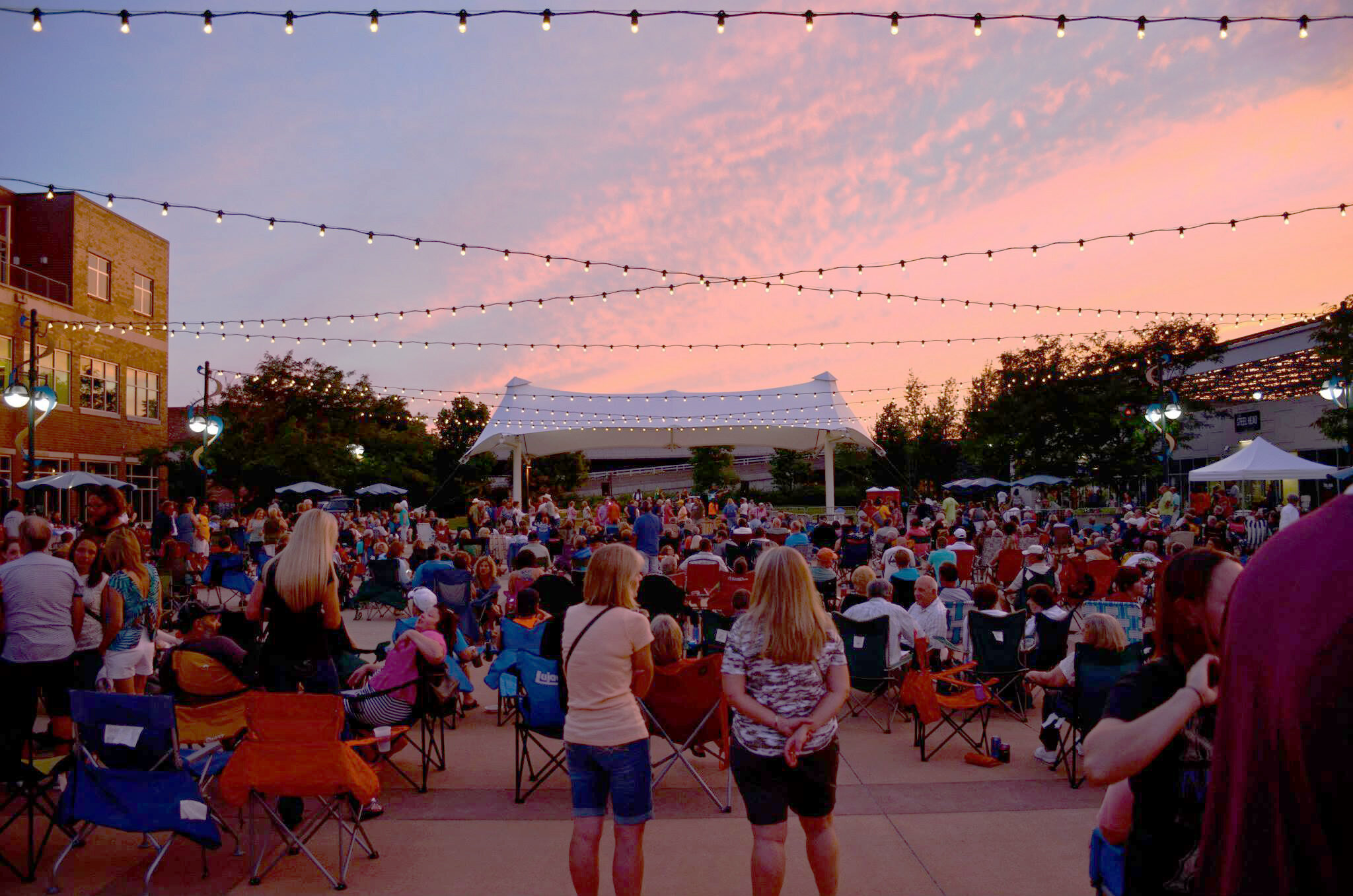
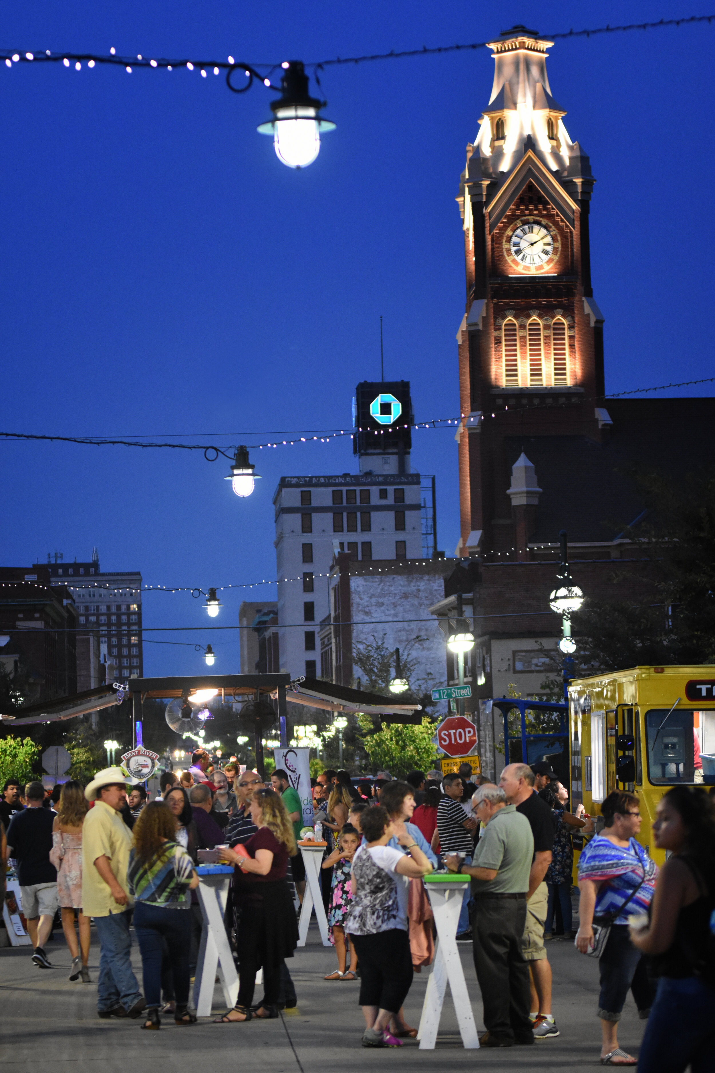
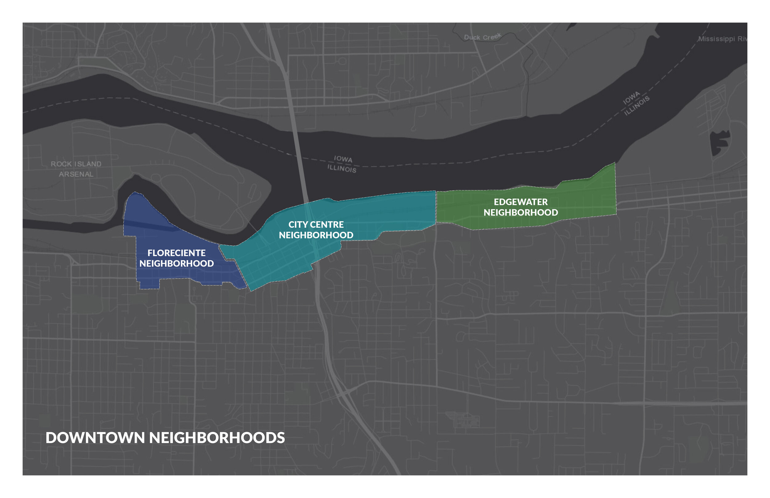
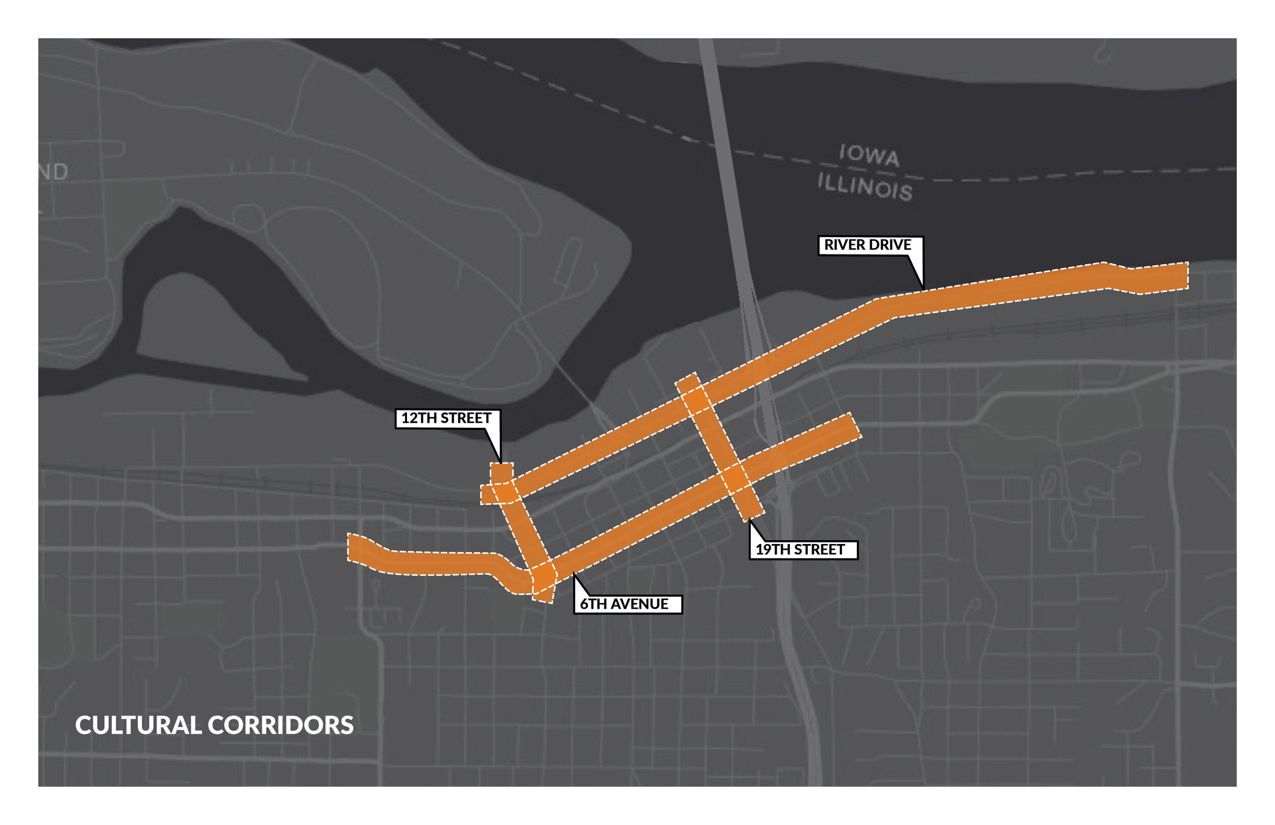
The City of Moline, Illinois is a Quad City bordered by the Mississippi River. As the gateway to the East, the city understands the value of first impressions, which is why it set out to develop its first-ever Public Art Master Plan. The plan focused on downtown Moline and supported numerous other planning initiatives advancing redevelopment of the city center.
HOW
Designing Local hosted a robust public engagement program despite the global pandemic. A series of stakeholder meetings and focus groups were held with various organizations and community leaders. Students from Augustana College and Black Hawk College participated in virtual public events called ‘Walkabout Talkabout Public Art’, during which they were asked to consider seven different types of sites and how public art could impact them.
WHAT
The Moline Public Art Master Plan was adopted in 2021 and continues to influence public art policy and programs in the city.